
Maryland, Virginia, and D.C. Bracing for Narrow Weekend Snow Band That Could Drop 1–3 Inches Along the I-95 Corridor
WASHINGTON, D.C. – A fast-moving weekend storm could paint a thin but impactful stripe of snow from the Ohio Valley into Maryland, Virginia, and the Washington, D.C., area, with some spots along the I-95 corridor potentially picking up 1–3 inches by early Sunday morning, according to early model projections.
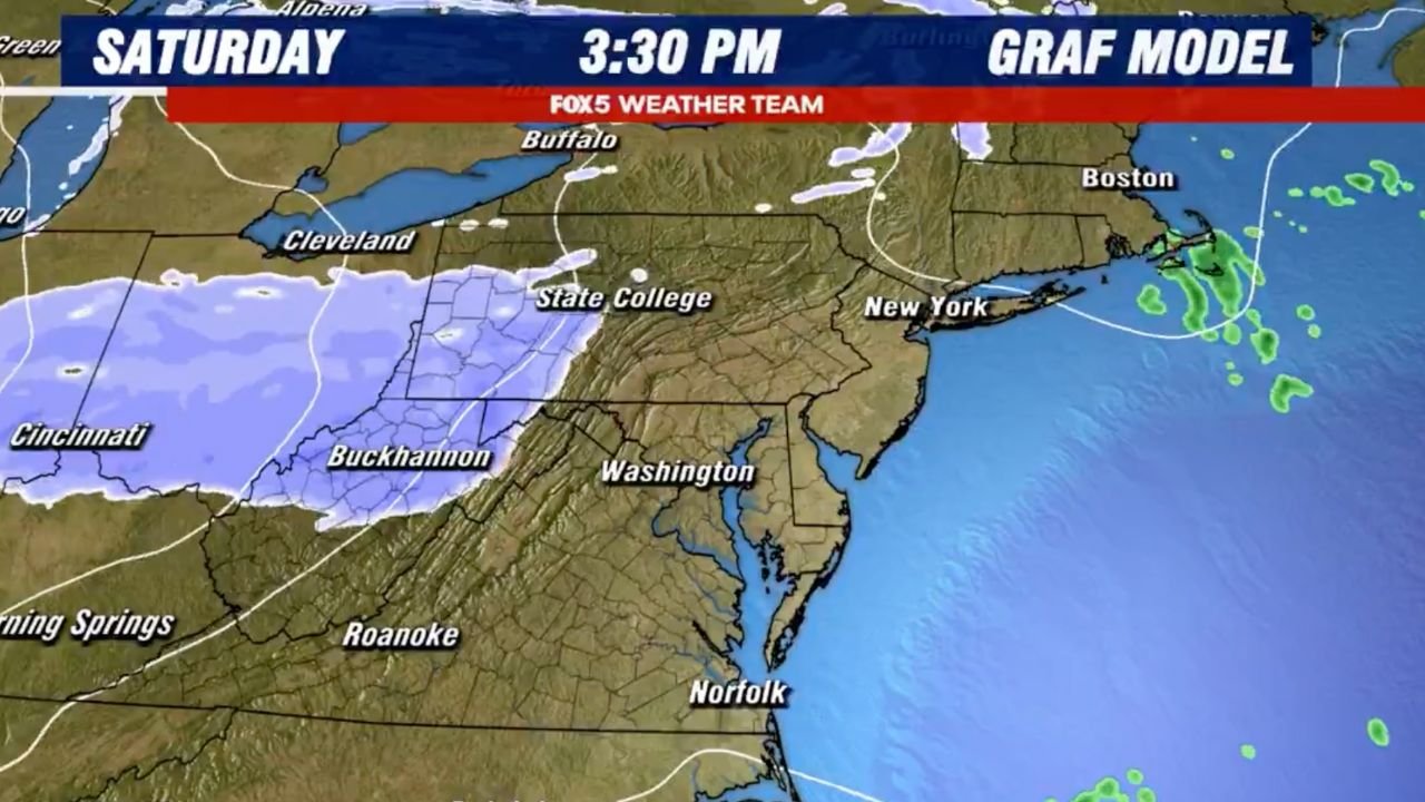
Fast-Moving System Arrives Saturday Evening
Forecast guidance from the GRAF model shows the system organizing on Saturday afternoon and evening, first spreading a shield of light wintry precipitation from Cincinnati, Ohio, through Buckhannon, West Virginia, and into central Pennsylvania near State College.
Precipitation may start as a mix of rain and wet snow Saturday night, especially south and east of the mountains, as surface temperatures hover near freezing. As colder air filters in behind the disturbance, that mix is expected to change over to mainly snow overnight, particularly from western Maryland into the D.C. metro and along I-95 into northern Maryland.
Snow Band Targets I-95 From D.C. Through Maryland
Model output highlights a narrow, focused band of steadier snow developing from near Washington, D.C., northeastward along the I-95 corridor in Maryland. Within this strip, forecasters see the potential for 1–3 inches of accumulation, with locally higher totals possible where the band lingers the longest.
Areas just outside the core of the band – including parts of northern Virginia and southern Pennsylvania – may see light coatings to around an inch, while locations farther south toward Norfolk, Virginia, likely remain on the fringe with mainly rain or flurries and little accumulation.
Because the snow shield is so narrow, small shifts in the track could mean the difference between wet roads and plowable snow for communities on either side of the band.
‘Razor’s Edge’ Setup Means Higher-Than-Usual Uncertainty
Meteorologists describe this as a “razor’s edge” event – the kind where a shift of 25–50 miles in the placement of the band changes who gets meaningful snow. The GRAF model places the heaviest stripe from central Ohio into northern West Virginia and then east toward the Baltimore–Washington region, but other short-range models will need to be monitored to see whether that axis nudges north or south.
For now, residents along I-68, I-70, and I-95 from western Maryland into the D.C.–Baltimore corridor should be prepared for the possibility of slick roads late Saturday night through early Sunday, even if totals stay on the lower side.
Travel Impacts Most Likely Late Saturday Night and Early Sunday
Because the system is moving quickly, snow is expected to fall mainly overnight, when temperatures are coldest and road treatment is most challenging. Even 1–2 inches of fluffy snow falling in a short window can create hazardous driving conditions, particularly on untreated secondary roads, bridges, and overpasses.
Drivers planning late-night or early-morning trips on I-79, I-70, and I-95 should allow extra time, reduce speeds, and be ready for periods of reduced visibility during bursts of steadier snow.
What to Watch Over the Next 24–36 Hours
Forecasters will be closely tracking:
- Exact placement of the snow band across Ohio, West Virginia, Maryland, and northern Virginia
- Temperatures at the surface, which will determine how quickly any initial rain or mix turns to all snow
- Timing of the changeover near Washington, D.C., and Baltimore, which will influence whether roads are merely wet or briefly snow-covered at daybreak Sunday
If later model runs trend colder or push the band slightly south, more of northern Virginia and the D.C. metro could see accumulating snow. A nudge north would shift the focus toward central and eastern Pennsylvania and away from the immediate I-95 corridor near D.C.
Stay Prepared and Share What You See
Residents from Cincinnati, Ohio, through Buckhannon, West Virginia, to Washington, D.C., and Baltimore, Maryland, should keep an eye on updated forecasts and be ready for at least minor travel disruptions late Saturday night into early Sunday.
Stay with WaldronNews.com for the latest track changes, snowfall projections, and road condition updates – and after the storm, share your local snowfall totals and travel reports so neighbors across the region can stay informed.