
Buffalo–Rochester Corridor Faces High Wind Event Monday With Gusts Up to 65 MPH, Power Outages and Tree Damage Possible
WESTERN NEW YORK — A classic southwest high wind event is expected to impact the Buffalo–Rochester region of New York on Monday, with wind gusts potentially reaching 60 to 65 mph, according to forecast models and National Weather Service guidance.
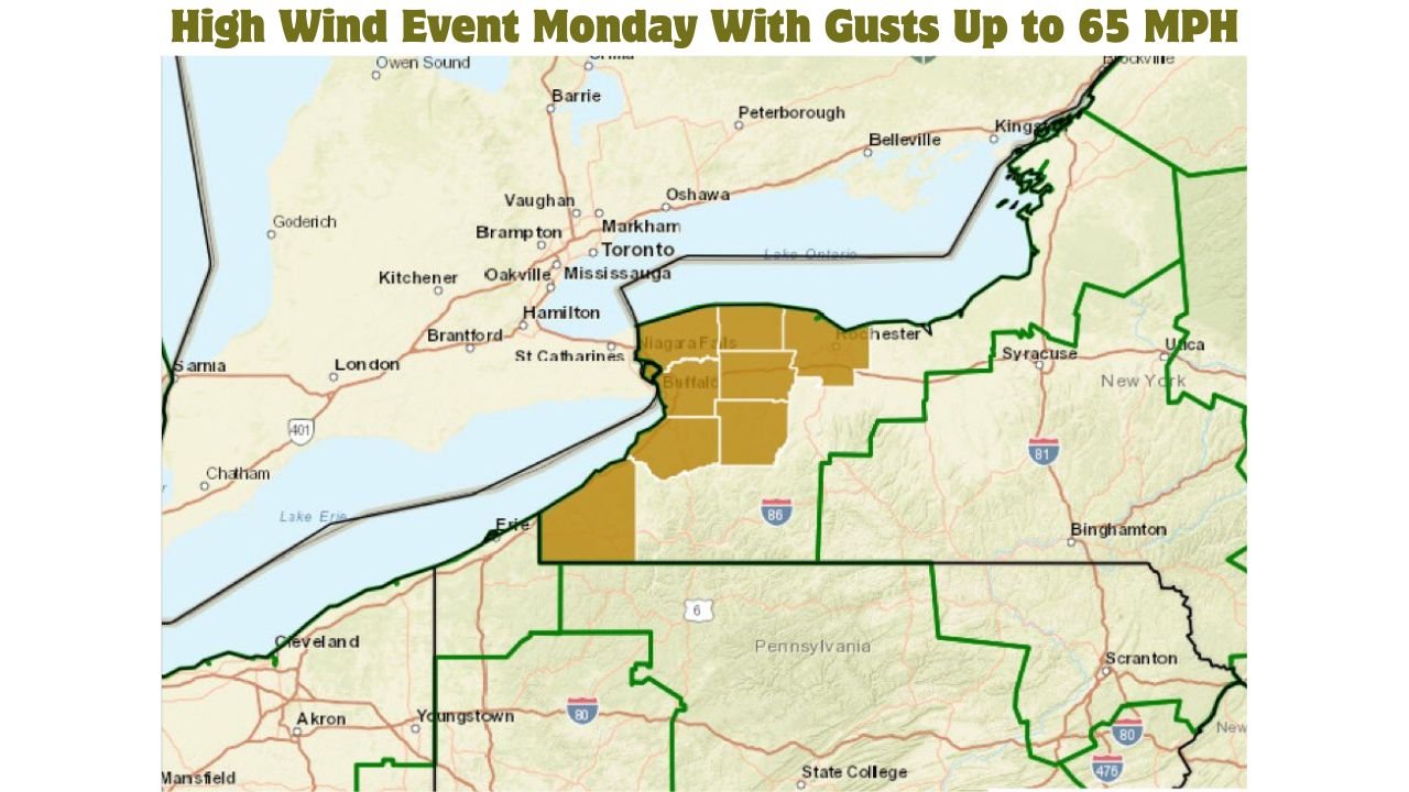
A High Wind Watch has been issued for portions of Western New York, including areas near Buffalo and Niagara County, as forecasters warn that antecedent wet ground conditions could significantly increase the risk of downed trees and power outages during the peak of the event.
High Wind Watch Issued for Western New York
The High Wind Watch is currently in effect for parts of Niagara Frontier and nearby inland counties, generally from early Monday morning through late Monday night.
Forecasters note that confidence is increasing that warning-level wind gusts may occur, especially in exposed areas and locations closer to Lake Erie.
How Strong Could the Winds Get
Based on ECMWF and other global model guidance:
- Widespread gusts of 45–55 mph are likely
- Peak gusts of 60–65 mph are possible in the Buffalo–Rochester corridor
- Strongest winds expected in southwest flow, a setup known to favor wind amplification in this region
These wind speeds are strong enough to cause tree damage, sporadic structural impacts, and power disruptions.
Why This Setup Is Concerning
Several factors are aligning to elevate the impact potential:
- Strong southwest winds aloft mixing down to the surface
- A tight pressure gradient associated with a deepening low-pressure system
- Saturated soils from recent precipitation, making trees more prone to uprooting
This combination increases the likelihood of trees falling even in non-thunderstorm conditions.
Timing: When the Worst Winds Are Expected
Current projections suggest:
- Winds begin increasing: Early Monday morning
- Peak gusts: Late Monday morning through Monday evening
- Gradual weakening: Late Monday night into early Tuesday
The duration of strong winds means impacts could accumulate over several hours, rather than occurring in brief bursts.
Potential Impacts Across the Region
Residents should prepare for:
- Downed trees and large branches
- Scattered to locally widespread power outages
- Difficult travel for high-profile vehicles
- Flying debris and hazardous outdoor conditions
Urban areas like Buffalo and Rochester may see street-level debris issues, while suburban and rural areas could experience more tree-related damage.
What Residents Should Do Now
Officials recommend that people in Western New York:
- Secure loose outdoor items
- Park vehicles away from trees when possible
- Charge phones and backup power devices
- Avoid unnecessary travel during peak wind hours
If forecast confidence continues to increase, the High Wind Watch may be upgraded to a High Wind Warning.
Bottom Line
A high-impact wind event is increasingly likely across Western New York on Monday, with the Buffalo–Rochester corridor facing wind gusts up to 65 mph. Given wet ground conditions, the risk of tree damage and power outages is elevated.
Residents should closely monitor updates and be prepared for potentially disruptive conditions.
Stay with WaldronNews.com for continued coverage, forecast updates, and any changes to watches or warnings as this event approaches.