
North Carolina, Virginia, New Jersey, and New England in Focus as WPC Flags Highest Risk for Heavy Snow This Weekend
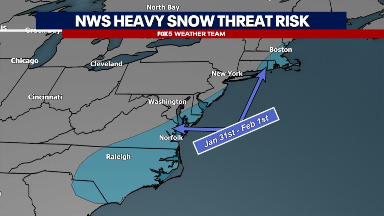
UNITED STATES — NOAA’s Weather Prediction Center (WPC) has issued an updated outlook highlighting central and eastern North Carolina, eastern Virginia, the Eastern Shore, parts of eastern New Jersey, and sections of New England as the regions with the greatest threat for heavy snowfall from a developing winter storm expected this weekend.
Forecast confidence continues to increase that a storm system will form, but where the heaviest snow ultimately falls remains highly dependent on the storm’s exact track, which is still uncertain several days out.
All Models Agree on a Storm — Track Will Decide Snowfall Winners and Losers
Meteorologists say one of the strongest signals in this forecast is that every major weather model shows a storm developing late Friday into Saturday. Where they differ is how far east or west the system tracks along the coast — a difference that will be critical in determining snowfall amounts and coverage.
A farther-west track would bring heavier snow farther inland across North Carolina and Virginia, while a more offshore track would limit significant snowfall to coastal areas and parts of New Jersey and New England.
Why the Carolinas and Virginia Are Being Closely Watched
The WPC’s latest guidance places central and eastern North Carolina and eastern Virginia near the heart of the potential snow zone. These areas sit close to the rain–snow transition line, meaning even small shifts in temperature or storm position could dramatically change precipitation type.
Forecasters note this setup favors sharp cutoffs, where communities just miles apart could experience vastly different impacts.
Eastern Shore, New Jersey, and New England Remain in the Snow Zone
Farther north, the Eastern Shore, eastern New Jersey, and New England remain solidly in play. Colder background air in New England increases confidence that precipitation will fall primarily as snow rather than rain, especially if the storm strengthens as it moves northeast.
Should the storm track closer to the coastline, moderate to heavy snowfall could develop in a narrow but impactful corridor.
Timing Window and Remaining Uncertainty
Current projections place the highest impact window between late Friday night and early Sunday, but forecasters caution that:
- Snow totals are still highly uncertain
- The western edge of snowfall could shift significantly
- Travel impacts may be concentrated rather than widespread
Greater clarity is expected once the system enters the 48–72 hour forecast window, when model agreement typically improves.
Bottom Line
Confidence is high that a winter storm will develop and moderate that snow will be a primary impact, especially for North Carolina, Virginia, New Jersey, and New England. However, exact snowfall locations and totals will hinge on storm track, which remains the key uncertainty.
Residents across the East Coast should closely monitor updates as the weekend approaches.
WaldronNews will continue tracking this system and provide updates as confidence and details increase.