
Snow Squalls and Arctic Front Threaten Western, Central, and Eastern Pennsylvania Ahead of Dangerous Cold Blast
UNITED STATES — A fast-moving winter setup is raising concerns across Pennsylvania as forecasters monitor the potential for widespread snow showers and intense snow squalls Friday afternoon and evening, followed closely by an arctic front that will send temperatures plunging into the weekend.
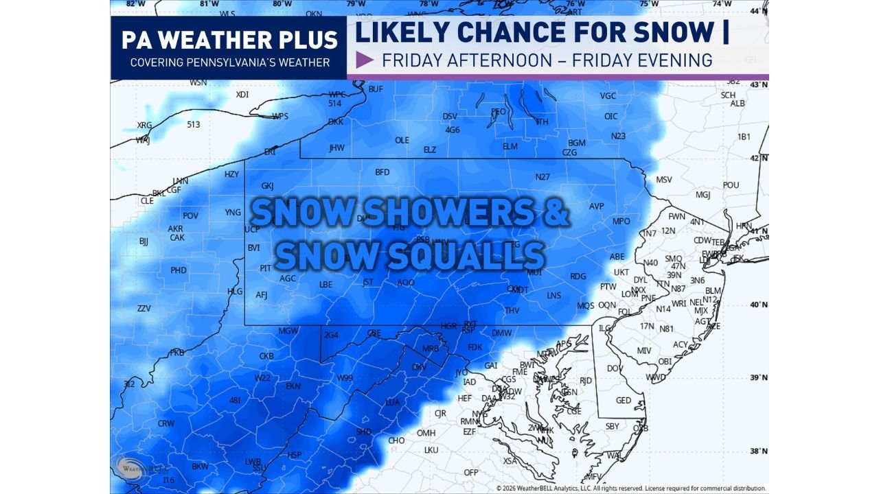
Meteorologists say a clipper system diving in from the northwest will be the main trigger for Friday’s snow activity, with the most disruptive impacts expected during peak travel hours.
Snow Squalls Likely Friday Afternoon and Evening
Forecast data shows a high likelihood of snow showers and snow squalls developing across much of Pennsylvania on Friday, especially from the afternoon into the evening hours.
The highest risk for accumulating snow is centered over western Pennsylvania, but forecasters caution that central and eastern Pennsylvania cannot be ruled out for sudden bursts of snow as well.
Snow squalls are particularly dangerous because they can:
- Develop rapidly with little warning
- Cause whiteout conditions
- Lead to flash freezing of roadways
- Severely reduce visibility in minutes
Even brief squalls can turn highways treacherous, especially along major corridors during the evening commute.
Western Pennsylvania at Greatest Risk, But Statewide Impacts Possible
While western Pennsylvania appears most favored for stronger snow bands, the setup supports scattered squalls across central and eastern portions of the state, depending on how the clipper evolves.
Localized accumulations may be uneven, but visibility and road safety — not snowfall totals — are the primary concern.
Arctic Front to Follow With Plunging Temperatures
Behind Friday’s system, an arctic front is expected to sweep through Pennsylvania late Friday night into Saturday.
As this front arrives:
- Temperatures will drop rapidly
- Any untreated wet roads could freeze quickly
- Additional snow showers or squalls may linger into Saturday
The combination of falling temperatures and gusty winds will significantly worsen conditions, even after snowfall tapers off.
Travel Impacts and Safety Concerns
Forecasters are especially worried about:
- Sudden whiteouts on highways
- Rapid ice formation after sunset
- Dangerous travel conditions during the afternoon and evening
Drivers are urged to slow down, leave extra space between vehicles, and be prepared for near-zero visibility if a snow squall hits.
What to Expect Next
Snow showers and squalls could continue intermittently into Saturday, with the cold air locking in across the region. Updates are expected as the timing and intensity of the squalls become clearer.
Residents across western, central, and eastern Pennsylvania should stay alert for changing conditions and be ready for rapid weather shifts.
Stay informed, stay cautious, and monitor local updates as this winter threat unfolds.
What are you seeing where you live? Do you think snow squalls are more dangerous than heavy snowstorms? Share your thoughts and follow ongoing coverage at WaldronNews.com.