Strong Storm System Brings Heavy Rain Threat to Illinois, Indiana, Ohio, Kentucky, and Tennessee on Saturday While Severe Risk Remains Limited

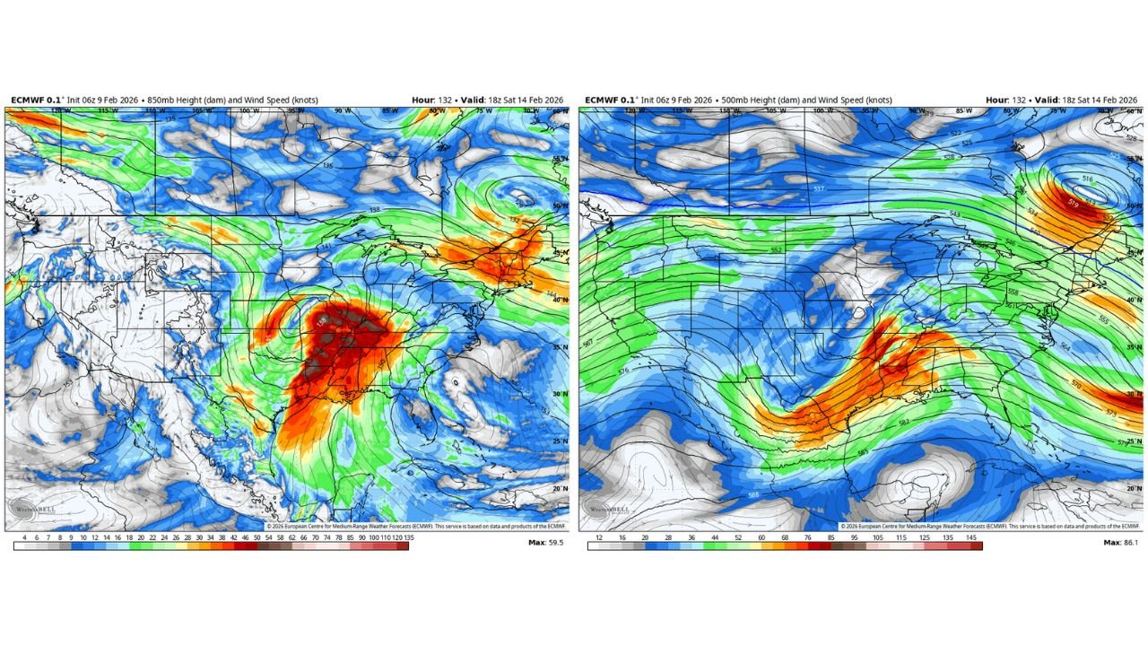
UNITED STATES — At first glance, new European (ECMWF) model guidance shows a large, organized storm system moving into the central and eastern United States by Saturday, raising early concerns for severe weather. However, a closer look at the atmospheric setup suggests that low instability will likely keep severe storms in check, shifting the primary concern toward widespread heavy rainfall.
The data points to a powerful upper-level disturbance lifting out of the central U.S., accompanied by strong winds aloft but limited surface-based instability.
Strong Upper-Level Winds Signal a Robust System
The 850mb and 500mb wind fields show a well-defined and strengthening system crossing the Midwest and Ohio Valley, with a pronounced surge of wind energy spreading from:
- Illinois
- Indiana
- Missouri
- Kentucky
- Tennessee
- Ohio
These wind speeds indicate a dynamically strong storm, capable of producing widespread precipitation and efficient moisture transport.
Low Instability Likely Limits Severe Weather Potential
Despite the impressive wind profile, the available data suggests instability remains low, which is a key limiting factor for organized severe thunderstorms.
This means:
- Thunderstorms may develop, but
- The environment is not strongly supportive of widespread damaging winds or tornadoes at this time
Forecasters note this setup is more supportive of heavy rain than classic severe weather, though trends will continue to be monitored through the week.
Heavy Rain Emerges as the Primary Impact
With strong lift and moisture transport present, the storm is shaping up to be a significant rain producer, particularly across:
- The Mid-Mississippi Valley
- The Ohio Valley
- Portions of the Mid-Atlantic later in the weekend
Rainfall efficiency could be high as the system matures, raising concerns for ponding on roads and localized flooding, especially in areas that have already seen recent rainfall.
Why This System Still Bears Watching
While severe weather potential appears limited for now, the system’s strength aloft means even small changes—such as increased instability or timing shifts—could alter impacts.
Key factors to watch this week include:
- Whether instability increases ahead of the system
- How quickly the main energy ejects east
- The eventual track of the surface low
Any of these could influence storm intensity or impact zones.
Bottom Line
Saturday’s storm system looks impressive on paper, but current data suggests heavy rain—not severe weather—will be the main story across Illinois, Indiana, Ohio, Kentucky, and Tennessee. While the severe threat appears limited for now, the system will remain under close watch as it evolves.
WaldronNews.com will continue tracking updates throughout the week as confidence and details improve.
