
Nebraska, South Dakota, and Iowa Face Ice Jam Flood Threat as Record Warmth Triggers Rapid Snow and Ice Melt
NEBRASKA — A surge of unusually warm temperatures across the central Plains is raising concerns about ice jam flooding, particularly in eastern Nebraska, where melting snow and river ice could create hazardous conditions in the coming days.
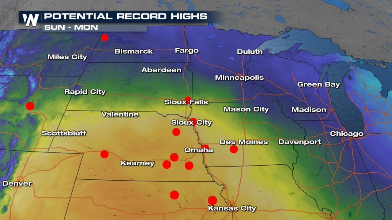
Weather data shows temperatures climbing well above normal, with potential record highs from Sunday into Monday, accelerating snowmelt and ice breakup along several river systems. As a result, a flood watch has already been issued for parts of eastern Nebraska due to ice jam flood potential.
Record Warmth Accelerates Snow and Ice Melt
Forecast maps indicate widespread warmth spreading across Nebraska, South Dakota, Iowa, and surrounding areas, with temperatures reaching levels more typical of late spring than mid-winter.
Cities including Omaha, Sioux City, Sioux Falls, Des Moines, Kearney, and Kansas City are positioned within the warmest zone, where rapid melting of existing snowpack and river ice is expected. The unusually fast thaw increases the risk that ice will break apart and pile up in narrow river channels.
Ice Jam Risk Focused on Key Nebraska Rivers
Hydrologic outlooks highlight the Platte, Elkhorn, and Loup Rivers as the primary areas of concern. Ice jams can form when broken ice becomes lodged in bends, bridges, or shallow sections of a river, causing water levels to rise quickly upstream.
The flood watch currently in effect covers areas near and upstream of Omaha, Fremont, Columbus, Norfolk, and Nebraska City, where river ice remains present and vulnerable to rapid movement.
Flood Watch Issued for Eastern Nebraska
Emergency officials are closely monitoring river conditions as temperatures continue to rise. While ice jam flooding can be localized, it can also develop rapidly with little warning, making early alerts critical.
Communities along affected rivers are urged to remain alert for sudden water level rises, especially in low-lying or flood-prone areas near riverbanks.
Why Ice Jams Are Dangerous
Unlike rainfall-driven flooding, ice jam floods can occur even without heavy precipitation. When ice blocks water flow, pressure builds quickly, potentially forcing water over banks or into nearby neighborhoods.
Key risks include:
- Rapid and unpredictable water rises
- Flooding upstream of ice blockages
- Damage to roads, bridges, and nearby property
What Happens Next
As long as warm temperatures persist, ice movement will continue to pose a threat. Any additional warming could worsen conditions, while a gradual cooling trend would help stabilize rivers.
For now, forecasters emphasize continued monitoring, especially through the early part of the week as temperatures peak.
Residents in flood-prone areas near the Platte, Elkhorn, and Loup Rivers should stay informed and be prepared to take action if water levels rise quickly.
Stay with WaldronNews.com for ongoing updates on flood watches, river conditions, and temperature trends across the central Plains