
Ohio and Pennsylvania See Isolated Strong Storms With Hail and Damaging Winds, But Tornado Risk Remains Low This Afternoon
PITTSBURGH, PA — Scattered strong to locally severe thunderstorms are developing across parts of Ohio and Pennsylvania this afternoon, but forecasters say the overall tornado threat remains minimal despite the active radar.
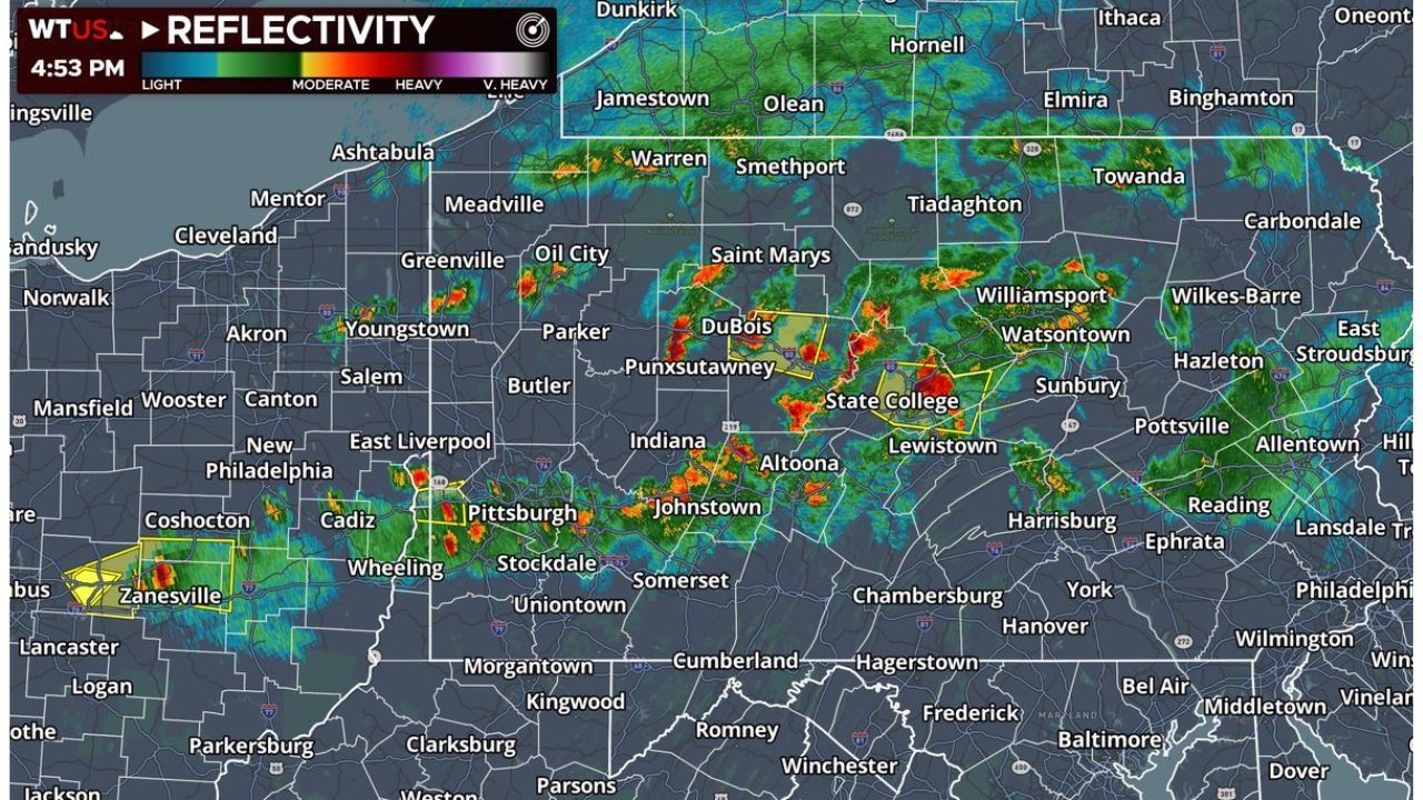
Storms are ongoing across areas including Zanesville, Youngstown, Pittsburgh, DuBois, State College, Altoona, and Williamsport, with additional scattered cells stretching through portions of western and central Pennsylvania and eastern Ohio.
Primarily a Wind and Hail Threat
Meteorologists indicate that the environment features very high lifting condensation levels (LCLs) — meaning cloud bases are elevated. This setup, combined with strong low-level mixing and veered wind profiles, significantly reduces the potential for tornado formation.
Instead, the atmospheric structure favors:
- Strong downburst winds
- Isolated large hail
- Brief heavy rainfall in stronger cells
So far, no widespread or significant wind or hail reports have been confirmed, though isolated impacts remain possible.
Why Tornado Risk Is Limited
Even though thunderstorms are capable of becoming strong, several factors are working against tornadic development:
- Elevated cloud bases limit low-level rotation potential
- Veered low-level shear reduces favorable spin alignment
- Storm structure remains somewhat disorganized
Forecasters describe the setup as “messy,” meaning storms are scattered and loosely organized rather than forming a cohesive severe line.
However, a few more organized cells could briefly intensify and produce localized severe weather hazards.
Areas Under Watch
Radar imagery shows the strongest activity concentrated across:
- Eastern Ohio, including areas near Zanesville and Youngstown
- Western Pennsylvania, including Pittsburgh
- Central Pennsylvania, including DuBois, State College, Altoona, and Williamsport
Storm movement suggests continued scattered development through the late afternoon and early evening hours.
What Residents Should Expect
While the tornado threat is currently low, residents in Ohio and Pennsylvania should remain alert for:
- Sudden bursts of strong wind
- Small to possibly large hail in isolated storms
- Rapidly changing weather conditions
Any stronger storm may briefly intensify before weakening.
Bottom Line
Today’s storms across Ohio and Pennsylvania are primarily a wind and hail event, not a tornado-driven outbreak. Most areas will experience brief, localized impacts rather than widespread severe damage.
Conditions will continue to evolve through the evening as storms gradually shift eastward and weaken after sunset.
Stay with WaldronNews.com for real-time updates on storm development and any warnings issued across the Ohio Valley and central Appalachians.