
Indiana Storm Alert Now Live As Scattered Severe Thunderstorms Begin Developing And Moving Northeast With Damaging Winds Risk
INDIANA — A developing weather situation is now unfolding across the state as scattered thunderstorms begin forming over central Indiana and push toward the northeast, signaling the start of a potentially active evening.
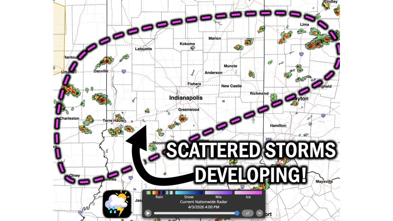
Radar trends clearly show storms firing near and west of Indianapolis, including areas like Terre Haute, Bloomington, and Greenwood, with additional cells popping up toward Muncie, Anderson, and Richmond.
Storms Already Developing Across Central Indiana
The current setup is not waiting — storms are already forming and expanding in coverage, especially across:
- Indianapolis metro area
- Western Indiana (Terre Haute region)
- Central to eastern corridors toward Muncie and Richmond
These storms are expected to continue building and spreading northeast, impacting more communities through the evening hours.
Main Threats Include Heavy Rain, Lightning, And Strong Winds
As storms intensify, residents can expect:
- Heavy downpours reducing visibility and causing localized flooding
- Frequent lightning with stronger cells
- Wind gusts reaching 50 to 60 MPH
- Potential for small hail in stronger updrafts
While this is not currently a widespread severe outbreak, individual storms could quickly strengthen, bringing localized impacts.
Storm Movement Will Push Activity Toward Northeast Indiana And Ohio
The general storm motion is:
- From central Indiana → northeast toward eastern Indiana and western Ohio
Cities that may see increasing storm activity include:
- Indianapolis
- Kokomo and Marion
- Muncie and Anderson
- Richmond and areas near the Ohio border
Activity Will Remain Scattered But Impactful
Unlike a solid line of storms, this setup is scattered in nature, meaning:
- Some areas may see repeated storms
- Others may remain mostly dry
- Stronger cells will be hit-or-miss but capable of brief severe conditions
This type of pattern can be especially tricky because conditions can change quickly in localized areas.
Evening Hours Will Be Key For Stronger Storms
As we move deeper into the evening:
- Storms may increase slightly in intensity before weakening later tonight
- The combination of daytime heating and instability supports stronger cells during late afternoon into early evening
Stay Weather Aware As Storms Continue To Build
With storms already ongoing and expanding:
- Monitor radar frequently
- Be prepared for sudden heavy rain and gusty winds
- Move indoors if lightning is nearby
This is a developing situation, not a future forecast — storms are already in progress.
Stay with WaldronNews.com for real-time radar updates, storm alerts, and live coverage as these scattered storms continue to develop across Indiana and move toward the northeast this evening.