
Florida Watches West-Central Atlantic Low Pressure System Form by Thursday June 4 at 6:00 AM Forecast to Be Totally Non-Tropical With Weather Fronts Attached
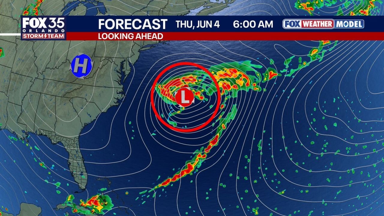
ORLANDO, Florida — A low pressure system is expected to form in the west-central Atlantic Ocean by Thursday, June 4, 2026 at 6:00 AM, and while it may catch attention on satellite images, forecasters are clear that this system will be totally non-tropical in nature. The system will have weather fronts attached and is expected to behave more like a winter-time storm than a tropical cyclone. Florida residents and East Coast weather watchers do not need to be concerned about tropical storm or hurricane development from this system.
What Non-Tropical Means and Why It Matters
A non-tropical low pressure system is fundamentally different from a hurricane or tropical storm in how it forms and what drives it. Tropical systems draw their energy from warm ocean water and have no fronts — they are symmetrical, warm-core storms with the most intense winds and rain near the center. A non-tropical system like the one forecast for the west-central Atlantic by Thursday, June 4 draws energy from temperature differences in the atmosphere and always has weather fronts attached, making it far less dangerous for land areas than a true tropical system.
What the Forecast Shows for Thursday June 4 at 6:00 AM
The forecast map valid for Thursday, June 4, 2026 at 6:00 AM shows the low pressure system positioned in the west-central Atlantic Ocean, well away from the Florida coast and the US mainland. A strong high pressure system is parked over the eastern United States, which is helping to keep this developing Atlantic system pushed away from shore. The combination of the offshore low and the onshore high pressure creates a pattern that limits any direct weather impacts for Florida and neighboring states from this system.
Why This System May Look Alarming on Satellite
During hurricane season, any swirling cloud pattern over the Atlantic can spark concern among residents watching satellite imagery. This developing low in the west-central Atlantic will produce visible cloud swirls and precipitation that could look dramatic on satellite by later this week, but the key indicator that separates this from a tropical system is the presence of fronts extending outward from the center. Tropical storms and hurricanes do not have fronts — the moment a system has fronts attached, it tells meteorologists this is not a tropical threat.
What Weather Fronts Tell Us About This System
Weather fronts are boundaries between air masses of different temperatures and are a hallmark of non-tropical, winter-style storm systems. When forecasters note that this developing west-central Atlantic low will have fronts attached, it is the clearest possible signal that the system cannot organize into a tropical cyclone. Forecasters specifically describe the pattern forming by Thursday, June 4, 2026 as being more like a winter-time system, meaning residents in Florida and along the coast can monitor it without concern about tropical storm or hurricane development.
The Bottom Line for Florida This Week
The low pressure system expected to be visible on satellite later this week and shown on forecast maps for Thursday, June 4, 2026 at 6:00 AM poses no tropical threat to Florida or the surrounding region. Forecasters have been consistent in their assessment that this system will be totally non-tropical, driven by atmospheric temperature differences rather than warm ocean water, and will carry the frontal structure of a winter-type storm rather than the symmetric, eyewall structure of a hurricane. Florida residents can watch this system form on satellite without treating it as a hurricane season concern.
WaldronNews.com will continue tracking the non-tropical west-central Atlantic low pressure system and will provide updates as the system’s forecast for Thursday, June 4, 2026 and its non-tropical characteristics develop.