
Arctic Air Targets New York, Pennsylvania, New Jersey and Virginia as Feb. 7–13 Cold Wave Looms
UNITED STATES — Just days after February opened with widespread cold, forecasters are now warning that another, potentially more severe blast of Arctic air could grip much of the Eastern United States between February 7 and February 13, bringing dangerously low temperatures and life-threatening wind chills.
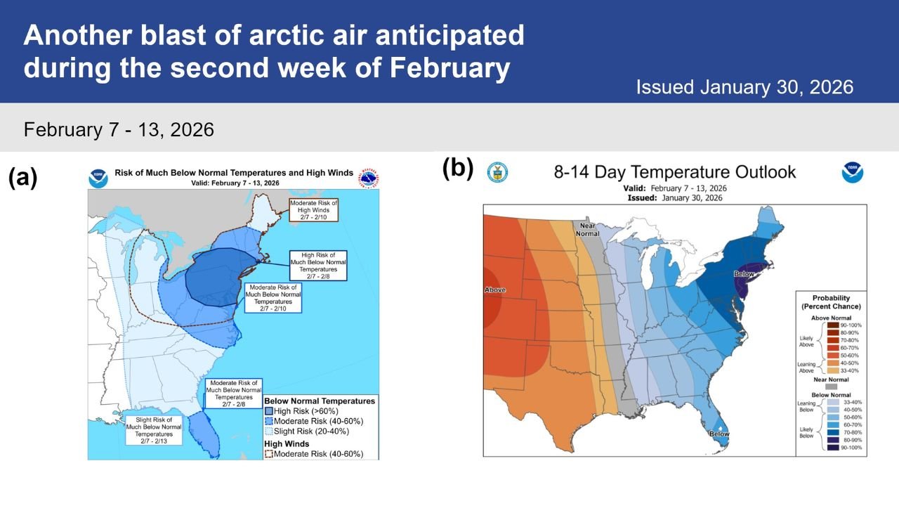
According to outlooks from the National Weather Service Climate Prediction Center, this next cold pattern could deliver much-below-normal temperatures across large portions of the East, with the highest risk centered on the Northeast and Mid-Atlantic.
High Risk of Extreme Cold Across the Northeast and Mid-Atlantic
Forecast guidance shows a high risk for significantly below-normal temperatures across the Northeast and Mid-Atlantic, particularly during February 7–8. Some areas could see near-record or record-breaking cold, especially overnight when Arctic air is strongest.
Strong winds accompanying the cold air mass may push wind chill values well below zero, increasing the risk of frostbite and hypothermia in a matter of minutes.
Cold Air Expected to Spread Deep Into the Eastern U.S.
The cold pattern is not expected to stay confined to the Northeast.
- Great Lakes and Upper Midwest: Prolonged below-normal temperatures
- Appalachians: Increased risk of sub-zero wind chills
- Southeast and Florida Peninsula: Below-normal temperatures possible February 7–8
- Entire Eastern U.S.: Elevated odds of colder-than-average conditions through mid-February
Forecast models indicate that below-normal temperatures could persist for several days, rather than passing quickly.
Strong Winds Could Make Conditions More Dangerous
High winds are expected to accompany the Arctic air, especially between February 7 and February 10. These winds will significantly increase the danger by lowering apparent temperatures well below actual air readings.
Weather officials caution that even brief outdoor exposure during peak cold periods could become hazardous, particularly overnight and during early morning hours.
Will the Pattern Break After Mid-February?
While colder-than-normal conditions are favored through the second week of February, forecasters note that a pattern shift may occur later in the month, allowing temperatures to gradually moderate. However, confidence in that change remains low at this time.
Residents are urged to prepare for extended cold, not just a short-lived cold snap.
Safety Officials Urge Cold Weather Precautions
Officials recommend that residents:
- Limit time outdoors during extreme cold
- Dress in insulated layers and cover exposed skin
- Protect pets, livestock, and vulnerable individuals
- Take steps to prevent frozen pipes and heating failures
This upcoming Arctic surge has the potential to be more dangerous than the cold that opened February, especially due to its duration and wind impact.
WaldronNews will continue monitoring this developing cold threat and provide updates as forecasts are refined. Stay with WaldronNews for the latest winter weather coverage.