
Arctic Blast Expected to Drive Temperatures Sharply Lower Across Arkansas as Major Pattern Shift Begins
ARKANSAS — A significant blast of Arctic air is increasingly likely to push into Arkansas later this week and into next weekend, bringing temperatures well below normal and signaling a sharp shift in the regional weather pattern. Multiple forecasting models now agree that the state is heading toward its coldest stretch of the season so far, with strong indications that the chill could linger for several days.
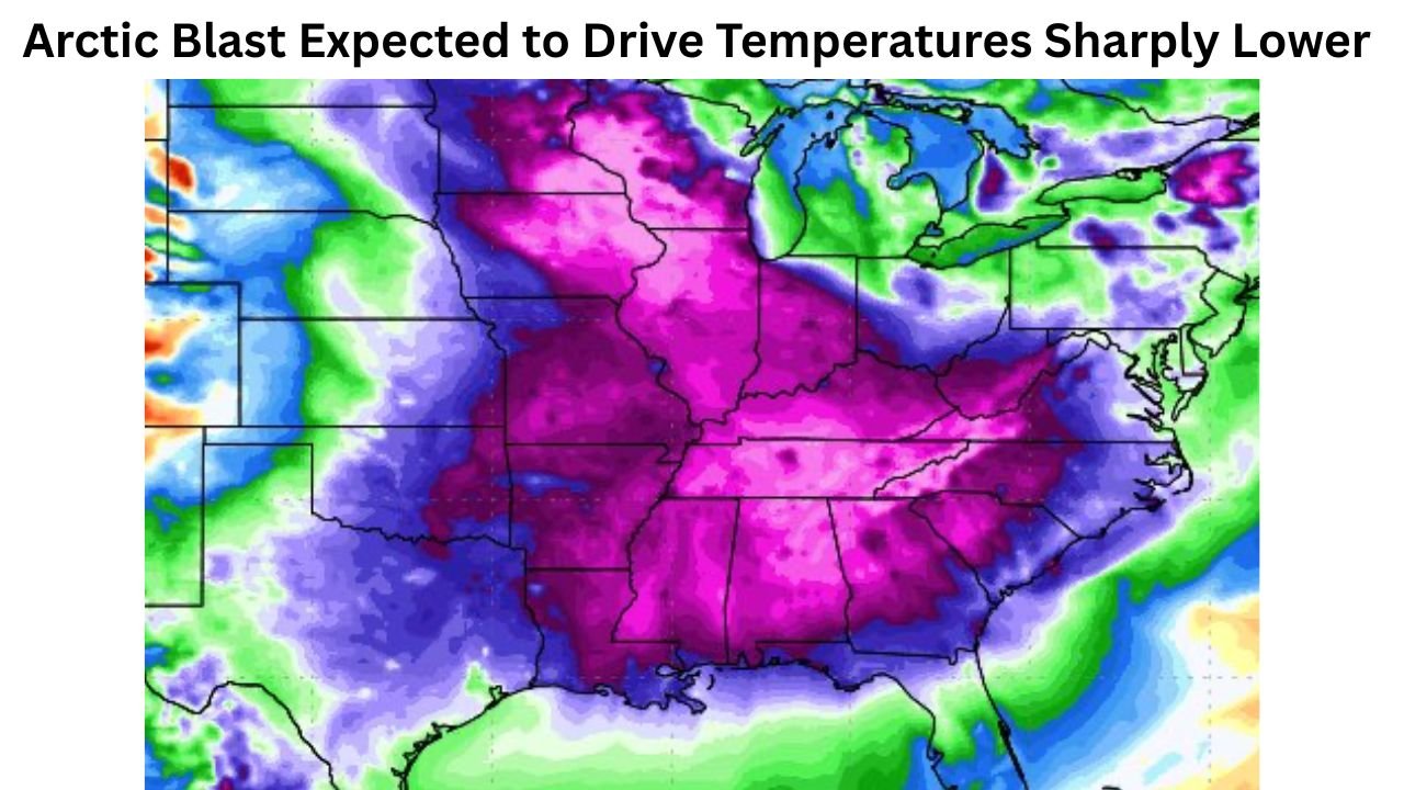
Models Show Deep, Widespread Cold Aiming for Arkansas
Meteorologists tracking long-range guidance say the latest temperature anomaly maps — shaded in deep purple and pink — represent strong signals of below-average temperatures spreading across the central U.S. Much of Arkansas sits directly within the projected core of this cold air mass.
The consistency across major forecasting systems is notable. While models often differ at extended ranges, the current agreement suggests higher confidence in a meaningful pattern change. A southward dip in the polar jet stream is expected to unlock frigid air from Canada, pushing it into the Midwest and then sweeping across Arkansas by late week.
What Arkansas Can Expect
Forecasters caution that exact numbers will continue to adjust, but early projections highlight a potentially impactful cold stretch:
- Overnight lows far below seasonal norms
- Daytime highs struggling to warm, especially in northern and western Arkansas
- A multi-day period of persistent cold, not a short-lived freeze
- Possible wind chill concerns, especially in the Ozarks and River Valley
While no major winter storm is indicated at this time, the combination of Arctic air and moisture later in the pattern will need to be monitored.
Potential Impacts Across the State
If temperatures drop as sharply as forecast, Arkansas residents could experience:
- Increased heating demand and higher short-term energy usage
- Frost and freeze conditions affecting agriculture and outdoor plumbing
- Icy travel hazards if even light precipitation overlaps with sub-freezing temperatures
- Elevated risks for cold-related illnesses during overnight and early morning hours
Meteorologists say this setup resembles classic mid-December Arctic intrusions that sometimes precede more volatile winter weather patterns.
Why Confidence Is Rising
Analysts point to “universal agreement” across major weather models — a rare indicator for extended-range forecasting. This alignment suggests the coming cold spell is not a temporary fluctuation but part of a broader shift toward a colder, more active pattern east of the Rockies.
Forecasters will continue refining the timing and intensity of the cold as shorter-range data becomes available.
Stay Prepared With WaldronNews.com
As Arkansas braces for a sharp drop in temperatures, WaldronNews.com will continue providing updates to help residents stay prepared. Check back frequently for new forecasts, cold-weather safety tips, and developing winter-weather advisories across the state.