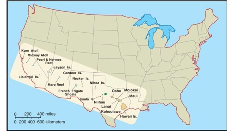
Map Shows Hawaii to Scale With Mainland U.S., Revealing Just How Vast the Aloha State Really Is
UNITED STATES — A newly highlighted map comparison is reshaping how many Americans visualize Hawaii, placing the island chain directly across the continental United States to show its true geographic scale. Instead of the small inset commonly seen in classroom maps, the illustration stretches Hawaii from the West Coast across the Southwest and into the…