
Blizzard Warnings Blanket Western Washington as 72+ Hours of Heavy Mountain Snow and Powerful Frontal System Threaten Major Travel and Flood Impacts
WASHINGTON — Blizzard Warnings are now in effect for portions of western Washington as a powerful and prolonged frontal system prepares to hammer the region with more than 72 hours of continuous precipitation, heavy at times.
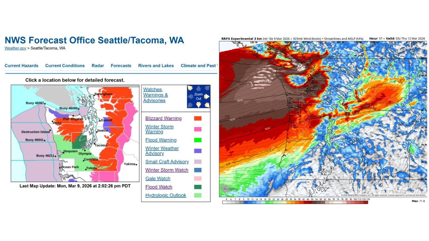
The National Weather Service office in Seattle/Tacoma has issued Blizzard Warnings and Winter Storm Warnings across key mountain zones, while Flood Warnings and additional advisories stretch across parts of the lowlands. The system is expected to intensify through midweek, bringing dangerous travel conditions in the Cascades and Olympics and periods of soaking rain in lower elevations.
Blizzard Warnings Focus on Mountain Passes
Blizzard Warnings are concentrated over the higher terrain of western Washington, including the Olympic Mountains and Cascade Range. These warnings indicate:
- Heavy snowfall
- Strong, gusty winds
- Blowing and drifting snow
- Visibility frequently near zero
Travel across mountain passes could become extremely dangerous or nearly impossible at times, especially during peak snowfall rates. With wind and snowfall overlapping, whiteout conditions are likely in exposed areas.
72+ Hours of Continuous Precipitation
Forecast models show a long-duration atmospheric river and frontal boundary aimed squarely at western Washington. The event is not expected to be brief.
Instead, waves of precipitation will repeatedly move inland, producing:
- Heavy mountain snow at higher elevations
- Moderate to heavy rainfall in lowland areas
- Strong onshore winds
Total precipitation projections show several inches of liquid equivalent across the Olympics and Cascades, with snowfall totals in the mountains expected to be significant over the multi-day period.
Powerful Wind Field Moving Inland
Upper-level wind projections indicate a very strong jet stream component feeding into the region. Coastal areas and mountain ridges will likely see the strongest gusts, but interior western Washington may also experience breezy to windy conditions as the frontal system advances inland.
Strong winds combined with saturated soils could increase the risk of downed trees and localized power outages, particularly in exposed areas.
Flood Concerns in Lowlands
In addition to blizzard conditions in the mountains, Flood Warnings and hydrologic concerns are present for parts of western Washington’s lower elevations.
With persistent rainfall over multiple days, rivers and streams will need to be closely monitored. Urban ponding and localized flooding are possible where heavy rainfall rates overlap with already wet ground.
Communities from the Olympic Peninsula through the Puget Sound region — including areas near Seattle, Tacoma, Everett, and Olympia — should prepare for periods of heavy rain and possible travel slowdowns.
Timing of Impacts
The system begins impacting the region in earnest over the next few days, with peak intensity likely midweek into late week. Snow levels will fluctuate, but sustained heavy precipitation in the mountains appears increasingly likely through at least Thursday into Friday.
This will be a prolonged event rather than a quick-moving storm.
What Residents Should Do
- Avoid mountain travel during Blizzard Warning periods
- Monitor river levels and local flood alerts
- Secure loose outdoor items ahead of stronger wind bursts
- Prepare for potential power outages
Western Washington is facing one of its more prolonged and impactful storm cycles of the season, with blizzard conditions in the high terrain and heavy rain in the lowlands occurring simultaneously.
WaldronNews.com will continue tracking updates as this powerful frontal system unfolds across the region.