
Boise Ridge Could Decide I-95 Blizzard Potential From Washington, D.C. to Boston as PNA Pattern Holds the Key
WASHINGTON, D.C. TO BOSTON — Whether the I-95 corridor sees a blockbuster blizzard or a complete miss may hinge on a feature thousands of miles away — a ridge building over the Pacific Northwest near Boise, Idaho.
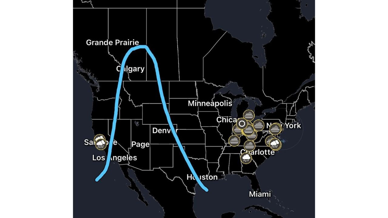
Meteorologists are closely watching the Pacific-North American (PNA) pattern, as a strong ridge over the Northwest could set off a chain reaction that delivers prolonged heavy snow from the Mid-Atlantic into New England.
Put simply: No ridge, no storm.
Why the Pacific Northwest Ridge Matters
A pronounced ridge over:
- Boise, Idaho
- The broader Pacific Northwest
- Extending into western Canada near Calgary and Grande Prairie
forces the jet stream into a highly amplified wave pattern downstream.
When that happens:
- A deep trough digs into the eastern United States.
- Arctic air is funneled southward into the Mid-Atlantic and Northeast.
- Upper-level energy ejects toward the East Coast.
That combination is a classic precursor for major nor’easter development.
Cold Air + Coastal Development = I-95 Snowstorm Setup
If the downstream trough deepens sufficiently:
- Cold air locks into place across Washington, D.C., Baltimore, Philadelphia, New York City, and Boston.
- Energy transfers to the coast.
- A coastal low forms along or just offshore of the I-95 corridor.
When a downstream Atlantic ridge blocks the system from quickly exiting, the storm can:
- Slow down.
- Intensify rapidly (explosive cyclogenesis).
- Produce prolonged heavy snowfall.
That’s the blueprint for a high-impact blizzard along the urban Northeast corridor.
Blocking Pattern Could Prolong Snowfall
A ridge over the western Atlantic acts as a traffic jam in the atmosphere. Instead of the storm racing out to sea, it lingers near the coastline.
The result can be:
- Extended snowfall durations.
- Stronger winds.
- Higher snowfall totals from D.C. to Boston.
Without this blocking component, storms often slide offshore too quickly to produce major impacts.
What Happens Without the Ridge?
If the Pacific Northwest ridge fails to build:
- The jet stream remains flatter.
- The eastern trough is weaker.
- Cold air supply is limited.
- Coastal development is suppressed.
In that case, the I-95 corridor could see:
- Light snow at best.
- Mixed precipitation.
- Or no significant storm at all.
That’s why forecasters emphasize that the ridge over Boise and the broader Northwest is the make-or-break ingredient.
Cities Most Sensitive to This Setup
The I-95 corridor cities most dependent on this pattern include:
- Washington, D.C.
- Baltimore
- Philadelphia
- New York City
- Boston
Small shifts in upper-level alignment can mean the difference between a moderate event and a crippling blizzard.
Watching the 500mb Charts
Meteorologists will continue monitoring 500mb height maps for:
- Strength of the ridge over Idaho and western Canada.
- Depth of the eastern trough.
- Signs of phasing energy along the East Coast.
- Development of Atlantic blocking.
If a strong ridge becomes evident over Boise on upcoming model runs, the odds of a significant I-95 snowstorm increase sharply.
Bottom Line
The fate of a potential I-95 blizzard from Washington, D.C. to Boston may be determined far upstream over the Pacific Northwest.
A strong PNA ridge over Boise can trigger amplified jet stream flow, Arctic air intrusion, coastal low development, and prolonged snowfall. Without it, the storm threat diminishes considerably.
WaldronNews.com will continue tracking upper-level pattern evolution as forecasters determine whether the ingredients for a major East Coast snowstorm come together.