
Brief Snow Burst Possible Early New Year’s Day as Cold Front Sweeps Through Washington D.C., Maryland, and Northern Virginia
WASHINGTON, D.C. — A sharp arctic cold front is expected to move through the Washington D.C. metro area, parts of Maryland, and Northern Virginia early Thursday morning on New Year’s Day, bringing the potential for a brief but intense burst of snow during the pre-dawn hours.
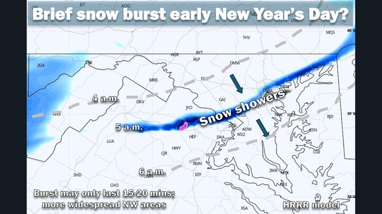
Weather data shows the front passing through the region between approximately 4 a.m. and 8 a.m. Thursday, with a narrow band of snow showers developing as colder air rapidly replaces milder conditions. While widespread accumulation is not expected, the setup could still create temporary hazardous travel conditions, especially during the early morning hours.
Short-Lived Snow Burst Could Reduce Visibility
Forecast models indicate that any snow associated with this system would likely be short in duration, lasting 15 to 20 minutes in most areas. Despite its brief nature, snowfall could fall heavily in spots, briefly reducing visibility for drivers.
Gusty winds accompanying the cold front may also blow snow across roadways, making conditions appear worse than accumulation totals alone would suggest.
Rapid Temperature Drop Raises Ice Concerns
One of the primary concerns with this system is the sharp temperature drop immediately following the frontal passage. Temperatures are expected to fall into the upper 20s, increasing the risk that any moisture on road surfaces could freeze quickly.
Even a light coating of snow or residual moisture could result in slick patches, particularly on bridges, overpasses, and untreated roads and sidewalks.
Snow May Miss Some Areas Entirely
Not all locations are expected to see snow. The snow burst is forecast to be hit-or-miss, with some areas seeing no snowfall at all. Data suggests a slightly better chance of snow northwest of the immediate D.C. metro, though exact placement remains uncertain due to the fast-moving nature of the system.
With New Year’s Day being a holiday, traffic volumes may be lighter than usual, potentially limiting impacts. Still, anyone traveling early Thursday morning should be prepared for rapidly changing road conditions.
What Drivers and Residents Should Know
- Snow, if it occurs, may last only 15–20 minutes
- Snow could fall briefly but heavily, reducing visibility
- Gusty winds may blow snow across roads
- Little accumulation expected, but a quick coating is possible
- Temperatures drop into the upper 20s, increasing ice risk
Weather conditions can change quickly with systems like this, especially during overnight and early morning hours.
If you’re out early New Year’s Day and notice snow showers, slick roads, or rapidly dropping temperatures, share what you’re seeing and stay with WaldronNews.com for continued local weather updates and coverage.