
California Severe Weather Risk Emerges for Central Valley as Powerful Pacific Storm Brings Thunderstorm and Tornado Potential
CALIFORNIA — A rare but legitimate severe weather threat is shaping up across parts of California as a powerful Pacific storm system moves inland, placing the Central Valley at risk for strong to potentially severe thunderstorms on Wednesday, December 24.
Meteorologists say California only experiences a true severe weather setup once or twice a year, and current atmospheric conditions suggest this event could meet that threshold. Forecast models show increasing instability, strong upper-level winds, and modest low-level wind shear — a combination that raises concern for damaging storms and even isolated tornado development.
“This is one of those rare days where California has a real severe weather signal,” forecasters noted.
Powerful Pacific Trough Sets the Stage for Severe Storms
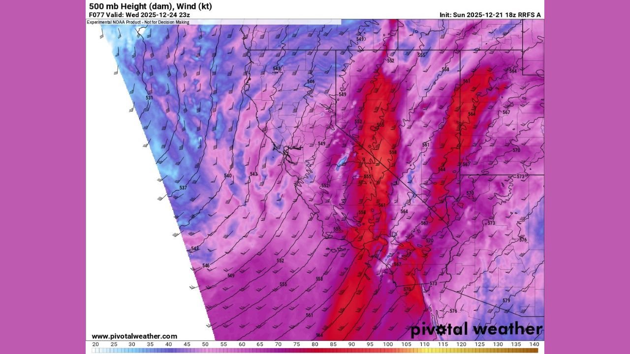
Forecast data shows a deep Pacific trough pushing into the state, placing parts of the Central Valley in the left-exit region of a powerful jet streak — a configuration known to enhance upward motion in the atmosphere.
At the 500-mb level, wind speeds increase dramatically, indicating strong upper-level support for thunderstorm development. This dynamic lift, combined with surface moisture and daytime heating, creates an environment favorable for organized convection.
“The atmosphere will be primed for storm development rather than just steady rain.”
Central Valley at Highest Risk for Strong to Severe Thunderstorms
The most concerning conditions are expected across California’s Central Valley, where destabilization is forecast to increase during the day. Model guidance indicates the potential for strong thunderstorms, with a few storms possibly becoming severe.
Composite radar simulations show bands of convection developing and moving inland, while forecast soundings reveal enough instability to support rotating updrafts in stronger cells.
Potential hazards include:
- Damaging wind gusts
- Intense downpours
- Small hail
- Isolated power outages
Brief Tornado Cannot Be Ruled Out, Forecasters Say
While widespread tornadoes are not expected, meteorologists caution that modest low-level wind shear combined with stronger storm cells means a brief tornado or two cannot be entirely ruled out, particularly within the most organized thunderstorms.
Energy Helicity Index values and storm-relative wind profiles suggest localized rotation could occur if storms intensify quickly.
“The tornado risk is low, but it is not zero — which is unusual for California.”
Storm Timing and Areas to Watch Closely
The severe weather window is expected to develop Wednesday afternoon into the evening, as the storm system reaches peak intensity. Areas to monitor most closely include:
- The Central Valley
- Interior Northern and Central California
- Locations east of coastal ranges where storms can intensify
Heavy rainfall may also accompany thunderstorms, raising concerns for localized flooding, especially in areas already saturated from recent storms.
Residents Urged to Stay Weather-Aware
Officials urge residents to closely monitor forecasts and be prepared to take action if warnings are issued. Thunderstorms in California can intensify rapidly, leaving little time to react.
“Even brief severe storms can cause damage and dangerous travel conditions.”
Residents should secure loose outdoor items, avoid flooded roadways, and have a plan in place if severe weather approaches.
Rare Severe Weather Setup for California
While severe weather is common in other parts of the country, California typically avoids the most intense storm dynamics seen elsewhere. This event stands out as a rare alignment of atmospheric ingredients capable of producing stronger-than-usual thunderstorms.
Forecasters emphasize that confidence will continue to increase as the event approaches, and updates are expected as newer data becomes available.
Have you experienced unusual weather or storm impacts in your area? Share your observations and stay updated with continuing severe weather coverage at WaldronNews.com.