
California, Washington, Oregon, Texas, Louisiana, Michigan, and New York Face Multi-Region Weather Hazards on Christmas Eve
UNITED STATES — Christmas Eve weather conditions across the country are unfolding with a wide range of hazards, as multiple regions experience rain, snow, fog, wind, and cold temperatures during Santa’s overnight journey, according to National Weather Service guidance and forecast model data.
While no single nationwide storm is dominating the pattern, several regional systems are creating travel and safety concerns from the West Coast to the Gulf Coast and parts of the Midwest and Northeast.
California Braces for Heavy Rain, Wind, and Mountain Snow
California is experiencing one of the most active weather patterns Christmas Eve, with heavy rainfall capable of localized flooding, gusty winds, and significant mountain snow impacting higher elevations.
Forecast imagery shows widespread precipitation across much of the state, particularly along coastal areas and mountain ranges, where snow levels remain high enough for hazardous travel conditions. Drivers crossing mountain passes may encounter rapidly changing conditions overnight.
Washington, Oregon, and the Great Basin See Rain and Snow Mix
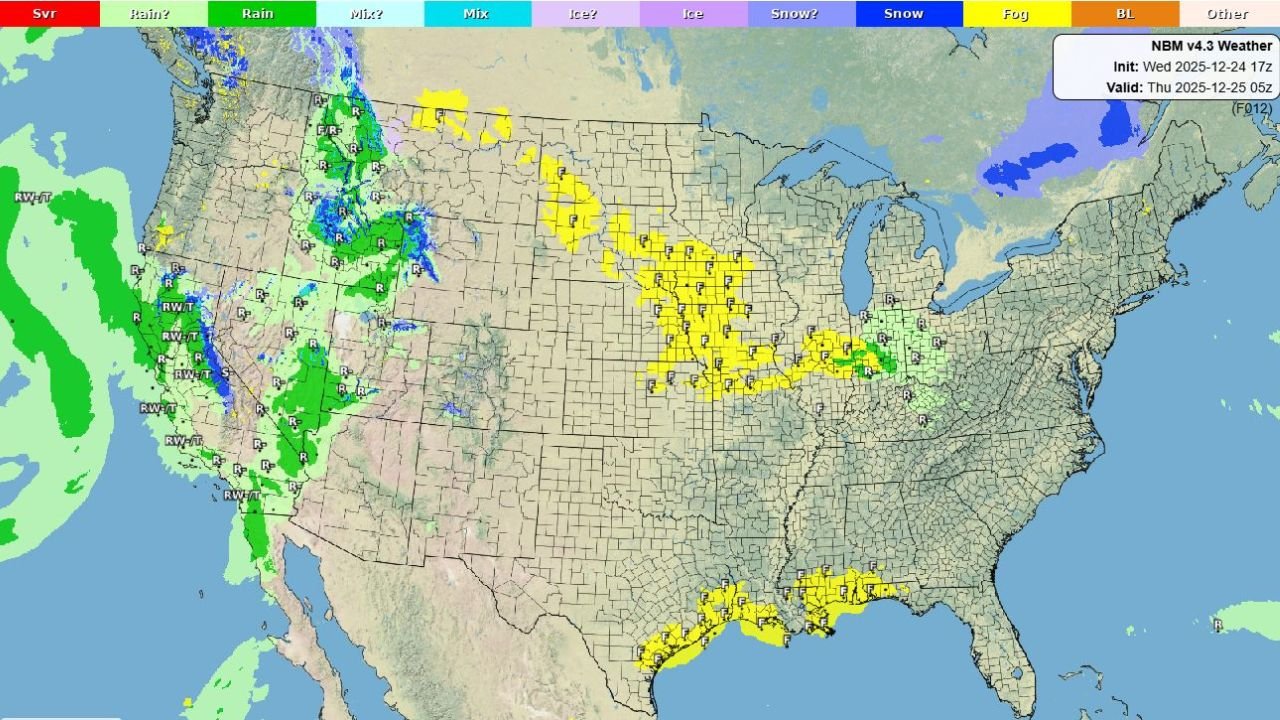
Across Washington, Oregon, and parts of the Great Basin, weather models indicate gusty winds, steady rain, and mountain snowfall, especially in higher terrain.
Snow is largely confined to elevated areas, but wind and wet road conditions may impact travel through mountain corridors and exposed valleys as systems continue moving inland.
Texas, Louisiana, and the Gulf Coast Deal With Dense Fog
In contrast to the western storminess, Texas, Louisiana, and Gulf Coast states are facing dense fog and areas of light rain, creating reduced visibility concerns.
Forecast maps highlight widespread fog development along coastal and inland Gulf regions, potentially affecting early-morning and overnight travel as Christmas Day approaches.
Michigan, Wisconsin, and the Midwest Experience Fog and Low Clouds
Portions of the Midwest, including Michigan and surrounding states, are under fog advisories, with low clouds and damp conditions dominating the region.
While snowfall is minimal in this area, visibility issues may still pose risks for overnight drivers and early Christmas morning travelers.
New York and the Northeast Remain Mostly Cloudy
In the Northeast, including New York, conditions remain relatively calm compared to other regions, with mostly cloudy skies and limited precipitation expected through the overnight hours.
No significant snow or rain impacts are currently forecast for major population centers during Santa’s Christmas Eve route.
Alaska Sees Cold Temperatures and Heavy Snow
Farther north, Alaska continues to experience cold conditions with areas of heavy snow, consistent with winter patterns across the state.
Snow accumulation remains focused in areas already accustomed to winter travel hazards.
Southern Rockies, Southeast U.S., and Hawaii Stay Mostly Clear
Meanwhile, the Southern Rockies, Southeast United States, and Hawaii are enjoying clear to partly cloudy skies, offering calmer conditions compared to the rest of the country.
These regions are largely spared from significant precipitation or visibility issues overnight.
Travel Awareness Encouraged Ahead of Christmas Morning
With weather conditions varying sharply by region, travelers are encouraged to check local forecasts and advisories before heading out, especially in areas impacted by fog, heavy rain, mountain snow, or gusty winds.
While Santa may have help navigating the skies, drivers on the ground should remain alert as Christmas Eve weather unfolds across multiple states.
For continued regional weather updates and holiday travel advisories, stay with WaldronNews.com.