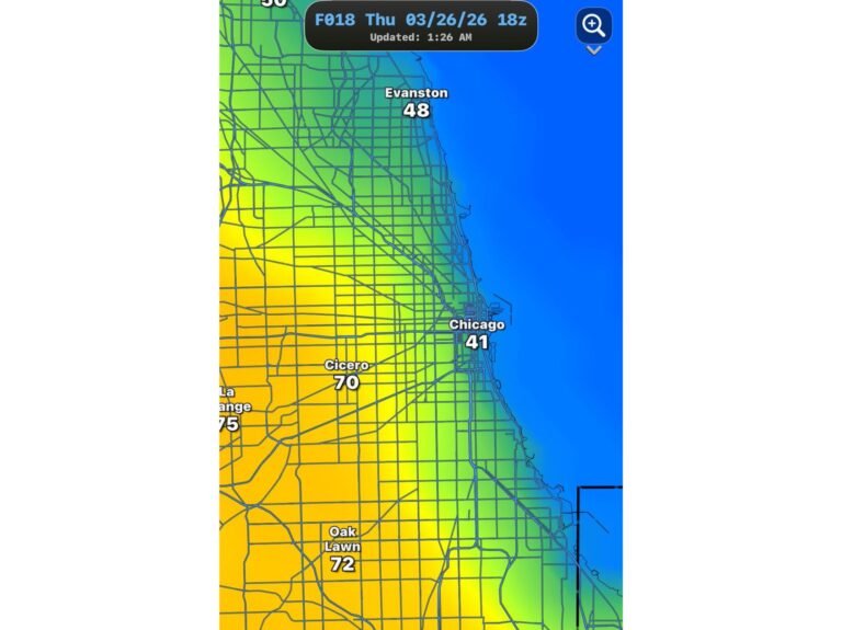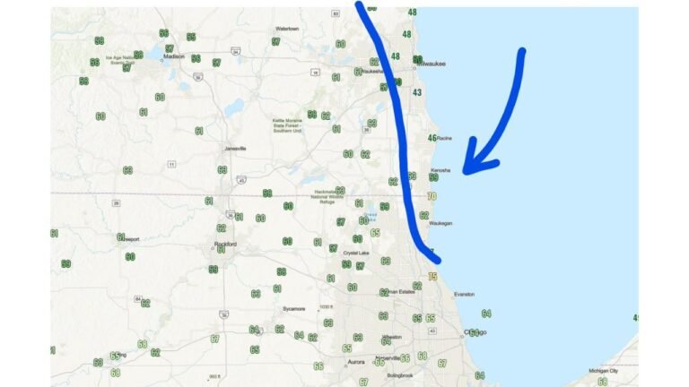
Illinois Including Chicago, Evanston and Gary Hit by Lake-Enhanced Cold Front With Temperatures Crashing From 60s Into 40s Within Hours
ILLINOIS — A lake-enhanced cold front is sweeping south along Lake Michigan, bringing a rapid and noticeable temperature drop across northeastern Illinois and northwest Indiana within a short window. Rapid Temperature Drop Along Lake Michigan Temperatures ahead of the front were sitting in the mid to upper 60s and even near 70 degrees, especially closer…