
Cold Grip Eases Across the Eastern U.S. as Pattern Shift Brings Milder Air and Above-Average Temperatures Next Week
UNITED STATES — After weeks of punishing cold, much of the eastern United States is finally beginning to break free from the deep winter chill. While winter is far from over, the most extreme cold is easing, and the change will feel noticeably more comfortable compared to the frigid conditions that dominated late January and early February.
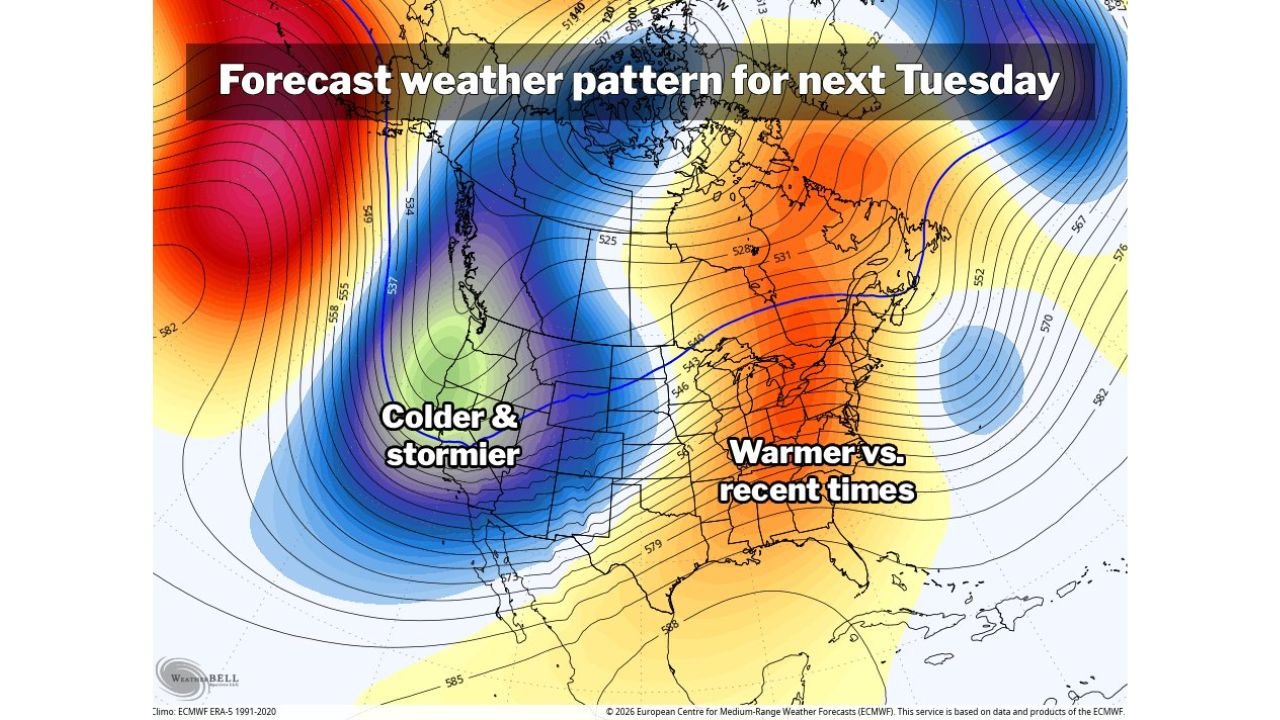
A large-scale shift in the continental weather pattern is driving the change. Forecast guidance shows storminess returning to the West Coast after a relatively quiet stretch, while the East transitions into a more seasonable — and potentially warmer-than-average — regime as we head into next week.
Sunshine and Moderating Temperatures This Week
Over the next several days, much of the eastern half of the country will see an increase in sunshine alongside gradually rising temperatures. Highs are expected to climb into the mid-40s in many areas, a marked improvement from recent subfreezing stretches.
Even with the warming trend, temperatures will generally remain slightly below average through the short term. For example, Washington, D.C., is projected to reach a high near 47 degrees around February 9 — still below seasonal norms, but a notable rebound from the harsher cold earlier this winter.
Late in the week, a brief dip in temperatures is possible, but conditions are expected to remain closer to typical February levels rather than anything extreme or memorable.
West Coast Turns Colder and Stormier
As the eastern U.S. warms, the West Coast is poised to take the opposite turn. Forecast maps show colder and stormier conditions developing across much of the western states, driven by a deep trough setting up over the region.
This shift allows colder air and unsettled weather to dominate the West while opening the door for milder air to surge eastward across the central and eastern U.S. The contrast between the two regions is a classic wintertime pattern, with energy focused on the West and relative warmth expanding east.
Next Week Could Bring Above-Average Warmth to the East
Looking ahead to next week, the pattern becomes more favorable for legitimately warmer-than-average temperatures across much of the eastern United States. Forecast models suggest several days with highs in the 50s are possible, with some locations potentially spiking even warmer for a brief period.
While this warmth may not last long — given the presence of a fairly active storm track across the country — there are currently no strong signals pointing to a renewed outbreak of intense cold immediately following the warmup.
Instead, temperatures are expected to remain closer to normal or slightly above, offering a welcome break from the harsh winter extremes seen earlier this season.
What This Means Going Forward
Winter is not finished, and storm chances remain in the broader pattern. However, the immediate threat of prolonged, bitter cold appears to be easing for now, especially across the eastern U.S.
For residents worn down by weeks of freezing temperatures, the coming stretch should feel noticeably more tolerable — even pleasant at times — as sunshine increases and temperatures trend upward heading into mid-February.
Have you noticed the warming already where you live? Share your local conditions and thoughts with readers at WaldronNews.com.