
Developing Cold Front and Deepening Low Could Bring Storm Line Across Florida, Georgia, and the Southeast by Sunday Morning
UNITED STATES — Forecasters are closely monitoring a frontal system expected to approach the Southeast next weekend, with the latest 12Z European (EURO) model guidance indicating a potentially active setup by Sunday morning.
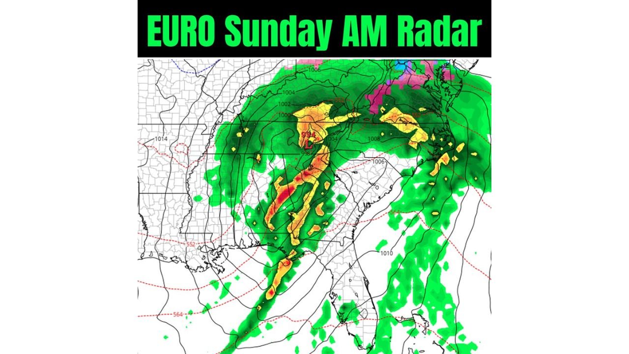
According to current model output, the developing system features a strengthening low-pressure center and a defined frontal boundary capable of producing a line of storms as it moves eastward across portions of the southeastern United States.
Timing Focused on Sunday Morning
The most recent EURO guidance places the frontal line moving through the region Sunday morning, though exact timing remains uncertain at this range.
The system is still close to key population centers, including Daytona Beach, Florida, where even small shifts in track or timing could significantly influence local impacts.
Deepening Low Pressure Raises Storm Potential
Model data shows lowering surface pressure values, a sign that the system may continue to organize as it approaches the Southeast. A deeper low often supports:
- Stronger lift along the frontal boundary
- A more organized line of precipitation
- The potential for embedded thunderstorms
At this stage, the data suggests storms are possible along and ahead of the front, rather than widespread severe conditions, but confidence remains limited.
Areas Currently in the Watch Zone
Based on the model depiction, regions to keep an eye on include:
- Florida, especially east-central Florida including Daytona Beach
- Georgia
- Portions of the Deep South and Southeast
Rainfall coverage appears widespread in the model output, with heavier precipitation concentrated near the frontal line.
Forecast Confidence Still Limited
Forecasters emphasize that several days remain before the system arrives, and key details are still subject to change. Factors that could shift include:
- The strength of the low-pressure system
- The exact placement of the frontal line
- Timing of storms across individual communities
Because of this, impacts could either increase or lessen as newer model runs arrive.
What Happens Next
Meteorologists will be watching future model cycles for:
- Consistency in the frontal timing
- Whether the low continues to deepen
- Signs of stronger or weaker storm development
At this stage, the signal is worth watching, but not locked in.
WaldronNews.com will continue tracking this evolving Southeast weather setup and provide updates as forecast confidence improves heading into the weekend.