
Eastern and Southeastern Nebraska Residents Told To Stay Alert As Potential Supercell Storm Cluster Signals Friday Risk
NEBRASKA — Residents across eastern and southeastern Nebraska are being advised to closely monitor weather conditions Friday afternoon as new forecast data signals the potential development of isolated supercell thunderstorms, which could bring severe weather risks to the region.
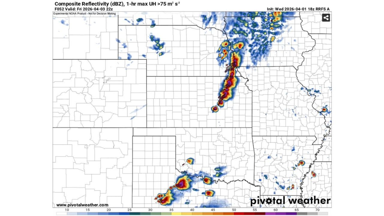
Early model guidance suggests storms may begin forming around 2 PM Friday, with activity focused across parts of far eastern and southeastern Nebraska, extending toward nearby areas.
Emerging Supercell Signal Raises Concern
The latest high-resolution forecast model indicates:
- A cluster of storms developing in eastern Nebraska
- Potential for supercell structures rather than just a solid storm line
- Storm intensification beginning during the mid-afternoon hours
Supercells are particularly concerning because they are capable of producing:
- Large hail
- Damaging winds
- Isolated tornadoes, depending on how atmospheric conditions evolve
Uncertainty Remains As Model Support Is Limited
At this stage, forecasters emphasize that:
- This signal is currently being shown primarily by one model solution
- Additional models, including later updates, are needed to confirm consistency
- The setup should be treated with caution but not ignored
This means the threat is conditional, but still important enough for residents to stay aware of updates as new data becomes available.
Storm Development Focused In Eastern Nebraska Corridor
The potential storm zone includes:
- Eastern Nebraska near the Iowa border
- Southeastern Nebraska extending toward Kansas and Missouri edges
Radar simulation imagery shows:
- A narrow but intense band of storms forming vertically across the region
- Additional scattered storm activity nearby
- Signs of strong updraft potential within the main storm cluster
If conditions align, storms could quickly become severe in localized pockets.
Why Timing Matters Friday Afternoon
The timing of storm development around early to mid-afternoon is critical because:
- Daytime heating can increase instability rapidly
- Storms forming during this window have a higher chance to strengthen quickly
- Any isolated storm that develops could become more organized before merging into clusters
Residents Urged To Monitor Updates Closely
People across eastern and southeastern Nebraska should remain prepared as the situation evolves.
Recommended actions:
- Keep weather notifications enabled
- Stay updated with new forecast model runs and alerts
- Be prepared for rapid changes in storm intensity Friday afternoon
- Identify a safe location in case warnings are issued
Situation Could Evolve Quickly With New Data
While confidence is still developing, this early signal highlights the possibility of targeted severe weather risk rather than widespread storms, which can sometimes be more dangerous due to their isolated nature.
Officials stress that further updates will refine the threat, but for now, residents in eastern Nebraska should treat Friday as a day to watch closely for developing storms.