
Eastern Iowa and Northwest Illinois Residents Put On High Alert As Strong Tornado Setup Emerges Thursday Afternoon
ILLINOIS — A dangerous severe weather setup is rapidly coming together across eastern Iowa and northwest Illinois, where conditions are aligning for what could become a focused and potentially strong tornado threat by Thursday afternoon and evening.
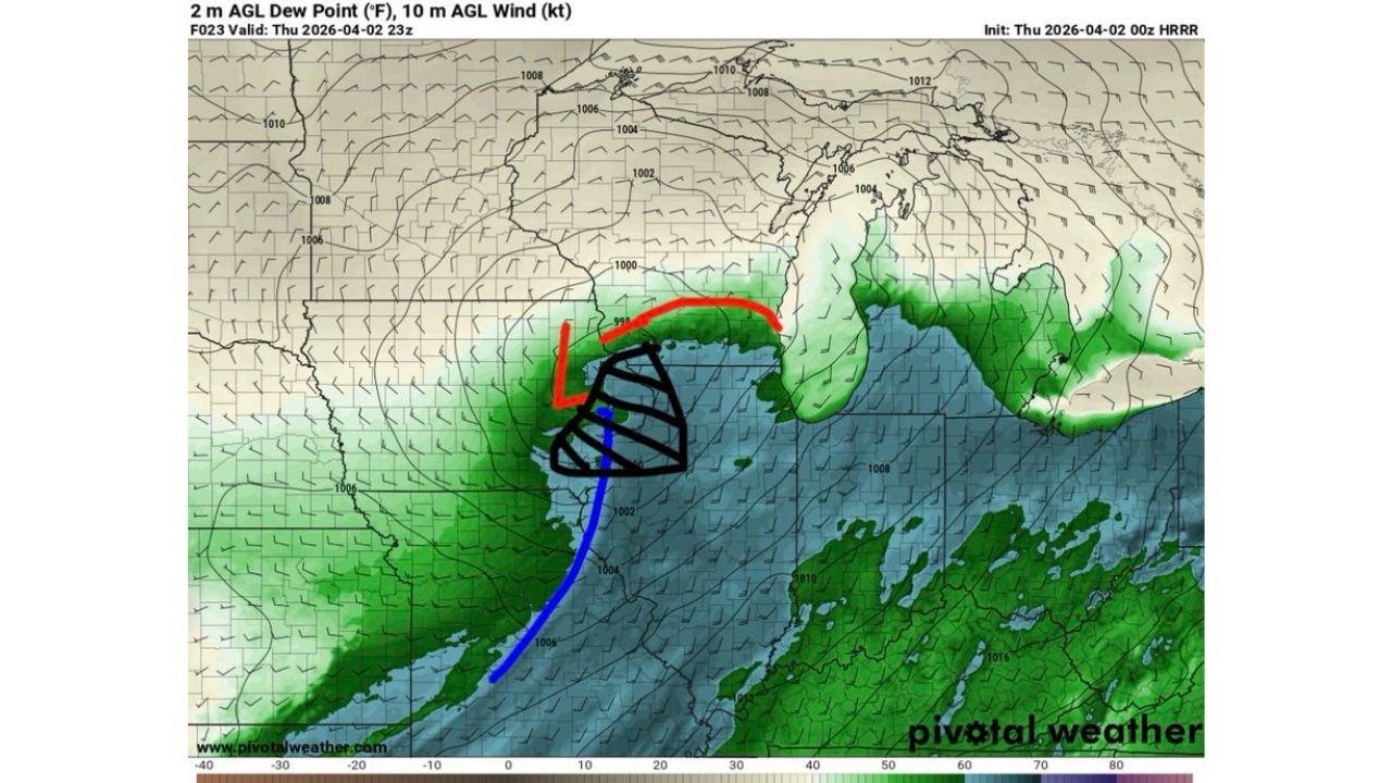
Forecast data highlights a surface low developing near eastern Iowa, creating a highly favorable environment for rotating storms across the region, particularly near the Iowa–Illinois border.
Tornado Threat Centered Near Iowa Illinois Border
The highest concern is concentrated across:
- Eastern Iowa including areas near Davenport
- Northwest Illinois including regions west and north of Peoria
This zone sits directly near the track of the surface low, a key ingredient for tornado development. As this system intensifies, it is expected to pull in rich low-level moisture from the south, increasing instability across the region.
Atmospheric Setup Strongly Supports Rotating Storms
Several critical atmospheric factors are coming together at the same time:
- Strong low-level wind shear is expected to develop, allowing storms to rotate easily
- An approaching upper-level shortwave system will enhance lift and storm organization
- Increasing moisture and instability will support rapid storm development by early afternoon
Forecast parameters indicate:
- High storm-relative helicity (SRH), which increases the chance of rotating updrafts
- Elevated low-level CAPE (3CAPE), meaning storms can quickly intensify near the surface
- Very low cloud bases (low LCLs), a key factor that supports tornado formation
Together, these ingredients create an environment capable of producing semi-discrete supercells, which are the type of storms most likely to generate stronger tornadoes.
Timing Will Be Critical As Clearing Develops
One of the most important factors in this setup is how quickly skies clear during the day.
- Morning clouds and rain may initially limit instability
- However, expected clearing by early afternoon across eastern Iowa and northwest Illinois could rapidly increase storm strength
- Once storms form, they may quickly transition into tornadic supercells
This means the threat could escalate quickly within just a few hours, catching some areas off guard if conditions improve faster than expected.
Storm Mode Could Favor Stronger Tornadoes
Unlike widespread storm lines, this setup may support:
- Semi-discrete storms
- More isolated but intense thunderstorm cells
- Greater potential for strong, longer-lived tornadoes
This type of storm structure is often associated with higher-end severe weather events, especially near the center of a developing low-pressure system.
Residents Urged To Monitor Conditions Closely
People living across eastern Iowa and northwest Illinois should take this setup seriously and prepare in advance.
Key actions include:
- Identifying a safe shelter location immediately
- Keeping weather alerts enabled on mobile devices
- Monitoring updates throughout Thursday, especially after midday
- Being ready to act quickly if warnings are issued
Rapid Changes Possible As System Develops
While uncertainty remains regarding exact storm coverage, the overall setup strongly suggests that any storm that forms in this region could become severe very quickly.
With multiple high-risk ingredients aligning at once, Thursday afternoon and evening could bring a dangerous window for tornado development, particularly near the Iowa–Illinois border where conditions appear most favorable.