
Eastern Mississippi Supercells Weaken as Storms Approach Instability Edge, Tornado Risk Remains Limited
MISSISSIPPI — Supercell thunderstorms moving across eastern Mississippi on Friday have begun to weaken as they approach the eastern edge of the region’s more robust atmospheric instability, according to mesoscale analysis and radar data. While the overall severe threat has decreased compared to earlier expectations, forecasters say a brief tornado or isolated severe wind gusts remain possible.
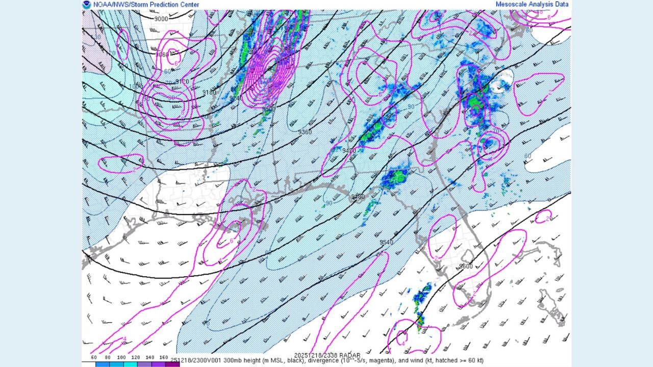
Storm Structure Showing Signs of Weakening
Radar and mesoscale analysis imagery indicate that storms entering eastern Mississippi are encountering less favorable instability, causing them to lose some organization. Ascent associated with the system has become displaced from the most discrete supercells, resulting in storms that are weaker and less structured than earlier in the event.
This displacement has reduced the ability of individual storms to maintain strong, sustained updrafts — a key ingredient for long-lived supercells and more significant tornado development.
Mesocyclones Still Present but Less Organized
Despite the weakening trend, radar imagery continues to show a few decently organized mesocyclones embedded within the broader line of storms. These rotating features confirm that the atmosphere is still capable of producing localized severe weather, even as the overall environment becomes less supportive.
Forecasters note that one or two brief tornadoes cannot be ruled out, particularly with storms that briefly re-intensify along localized boundaries. However, storms so far have remained relatively well-behaved compared to more volatile severe weather setups.
Severe Wind Gusts Still Possible
While the tornado threat appears limited, isolated severe wind gusts remain a concern with stronger storm cores. Any storm that can briefly organize may produce damaging straight-line winds, especially within the more consolidated sections of the line.
Residents across eastern Mississippi are advised to remain weather-aware as storms continue to move through the region.
What Happens Next
As storms continue eastward, further weakening is expected unless new pockets of instability are encountered. The current trend suggests a gradual decrease in severe potential, though isolated warnings may still be necessary if rotation or wind signatures intensify briefly.
Emergency officials and weather monitors will continue tracking radar trends closely through the remainder of the event.
Stay informed with the latest weather updates and local coverage by following WaldronNews.com.