
Florida Faces Dangerous Rip Currents, 14 Foot Seas And Heavy Rainfall Risk Through Sunday Into Monday
FLORIDA — Hazardous weather conditions are building across South Florida as strong winds, heavy rainfall, and dangerous marine conditions are expected to intensify through Sunday and continue into early Monday.
Forecasters warn that rip currents along Atlantic beaches have reached high risk levels, while offshore conditions are becoming increasingly dangerous with seas building between 9 and 14 feet in the Gulf Stream.
High Risk Rip Currents And Dangerous Surf Conditions
A HIGH RISK of life-threatening rip currents is in place across all Atlantic-facing beaches in South Florida through at least Monday.
Officials are strongly advising:
- Swimming is not recommended
- Follow all posted beach flags and lifeguard instructions
- Avoid entering the water even if conditions appear calm
Palm Beach County is also under a High Surf Advisory, with rough wave action expected to continue through Sunday night.
Storm Timing Overview
Hazard Risk Breakdown
Rip Currents
HIGH risk across Atlantic beaches
Marine Conditions
9–14 ft seas, strong winds
Heavy Rain
Flooding possible, 1–2 inches
Wind Gusts
Up to 30 MPH
Marine Conditions Becoming Increasingly Dangerous
Boaters face hazardous conditions across all South Florida waters:
- Small Craft Advisory in effect
- Seas building to 9–14 feet
- Winds from the northeast at 20–30 knots
The most dangerous conditions are expected over the Gulf Stream, where wave heights will be at their peak.
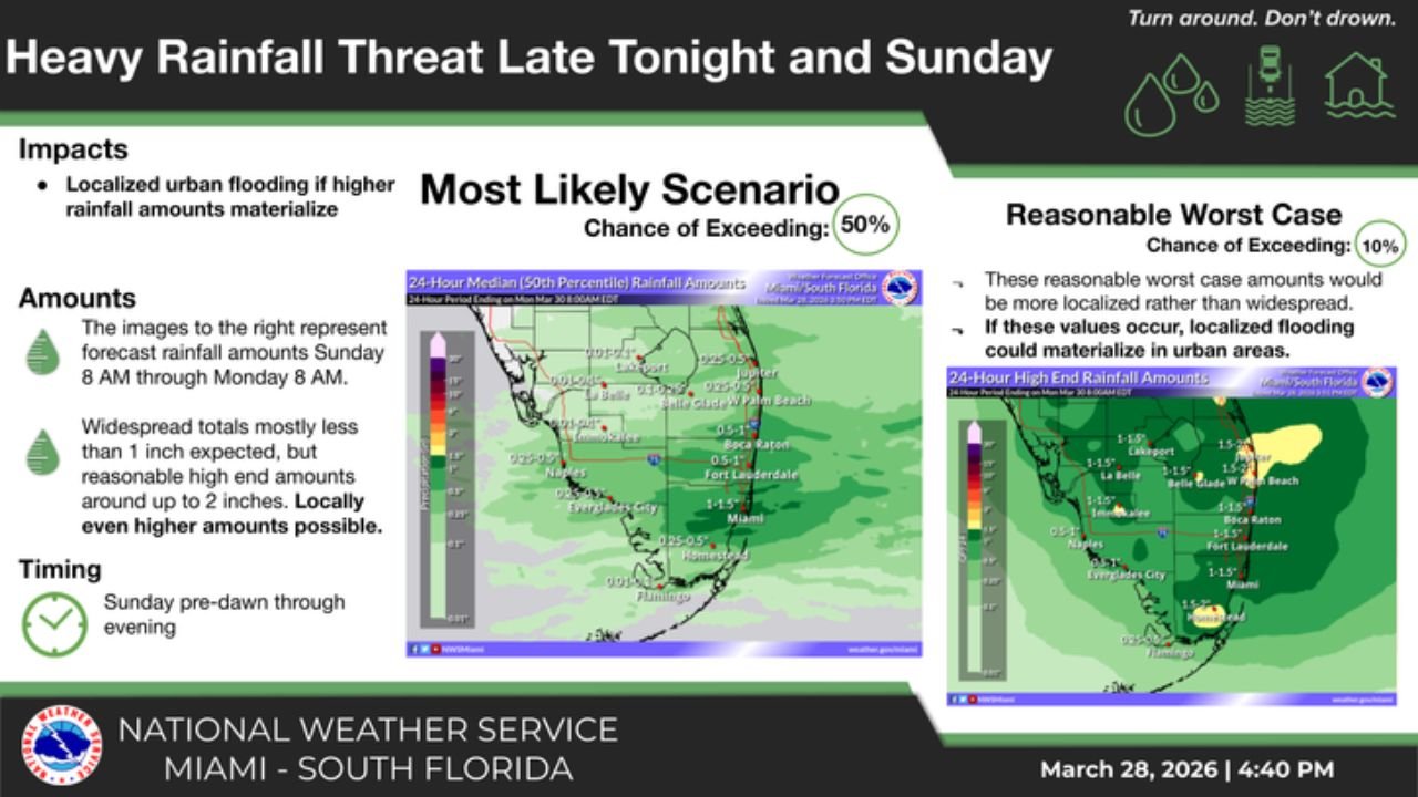
Heavy Rainfall And Flooding Potential
Periods of showers and storms will develop late tonight and continue through Sunday.
Key rainfall impacts include:
- Localized urban flooding possible
- Widespread rainfall totals near 1 inch
- Isolated areas could see 2+ inches
The most active rainfall window is expected from early Sunday morning through the afternoon and evening hours.
Final Outlook
South Florida is entering a period of multi-hazard weather, where marine dangers, flooding potential, and beach risks are all occurring simultaneously.
The combination of high rip current risk, dangerous seas, and heavy rainfall makes this a situation where residents and visitors should remain alert and avoid unnecessary exposure to hazardous conditions.
Stay Updated On Dangerous Weather Conditions
Get real-time alerts on flooding, marine hazards, and severe weather only on WaldronNews.com. Follow updates closely and share local conditions to help others stay safe.