
Freezing Rain to Create Dangerous Travel Conditions Across Virginia, Maryland, and Washington D.C. Overnight Into Saturday Morning
Richmond, Virginia — A Winter Weather Advisory has been issued across portions of Virginia, Maryland, and the Washington D.C. metro area as freezing rain moves into the Mid-Atlantic overnight. Forecasters warn that a thin glaze of ice could form on roads, bridges, and sidewalks, creating dangerous travel conditions through Saturday morning.
Freezing Rain Developing Overnight
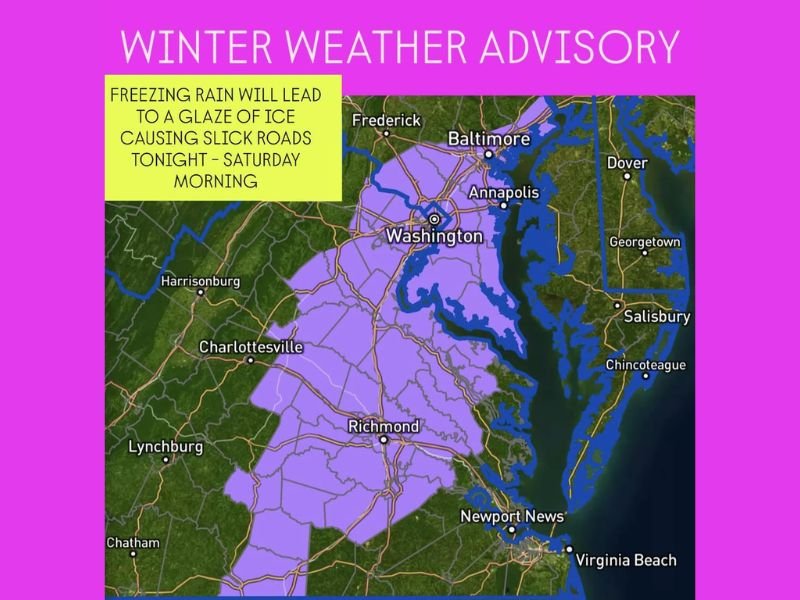
The National Weather Service reports that light freezing rain will spread north from central Virginia into Maryland late Friday evening, continuing into the early hours of Saturday. The highest risk for ice accumulation stretches from Richmond through Charlottesville, up toward Washington D.C., Baltimore, and Annapolis.
Temperatures near the surface are expected to remain below freezing for several hours, allowing even light precipitation to freeze on contact. Meteorologists warn that slick conditions may develop quickly, particularly on untreated roads and elevated surfaces.
Areas Most at Risk
- Central and Northern Virginia: Including Richmond, Charlottesville, and Fredericksburg
- Washington D.C. and Suburbs: Including Arlington, Alexandria, and Prince George’s County
- Central Maryland: Including Baltimore, Annapolis, and surrounding areas
Travelers along Interstate 95 from Richmond to Baltimore should be especially cautious, as freezing rain could make for dangerous early-morning travel before temperatures rise above freezing.
Morning Commute Hazards
By early Saturday morning, the freezing rain is expected to taper off, but lingering icy patches may persist on shaded or untreated roads. Motorists are advised to avoid travel overnight, if possible, and to drive slowly and allow extra braking distance if travel is necessary.
Authorities also urge residents to use caution when walking outdoors, as even a light glaze can create slippery sidewalks and driveways.
Improving Conditions by Late Morning
Forecasters say temperatures will gradually climb above freezing by mid to late morning Saturday, allowing the ice to melt. However, damp and cloudy conditions will continue into the afternoon as the system moves offshore.
Meteorologists caution that additional rounds of precipitation are possible early next week as another cold front approaches, potentially bringing a mix of rain and wintry weather to parts of the Mid-Atlantic once again.
Stay tuned to WaldronNews.com for the latest updates on this developing winter weather event and real-time forecasts across Virginia, Maryland, and the Washington D.C. region.