
Great Lakes, Northern Mid-Atlantic, and Southern New England Face Dangerous Wintry Mix as Freezing Rain, Sleet, and Snow Raise Power Outage Concerns
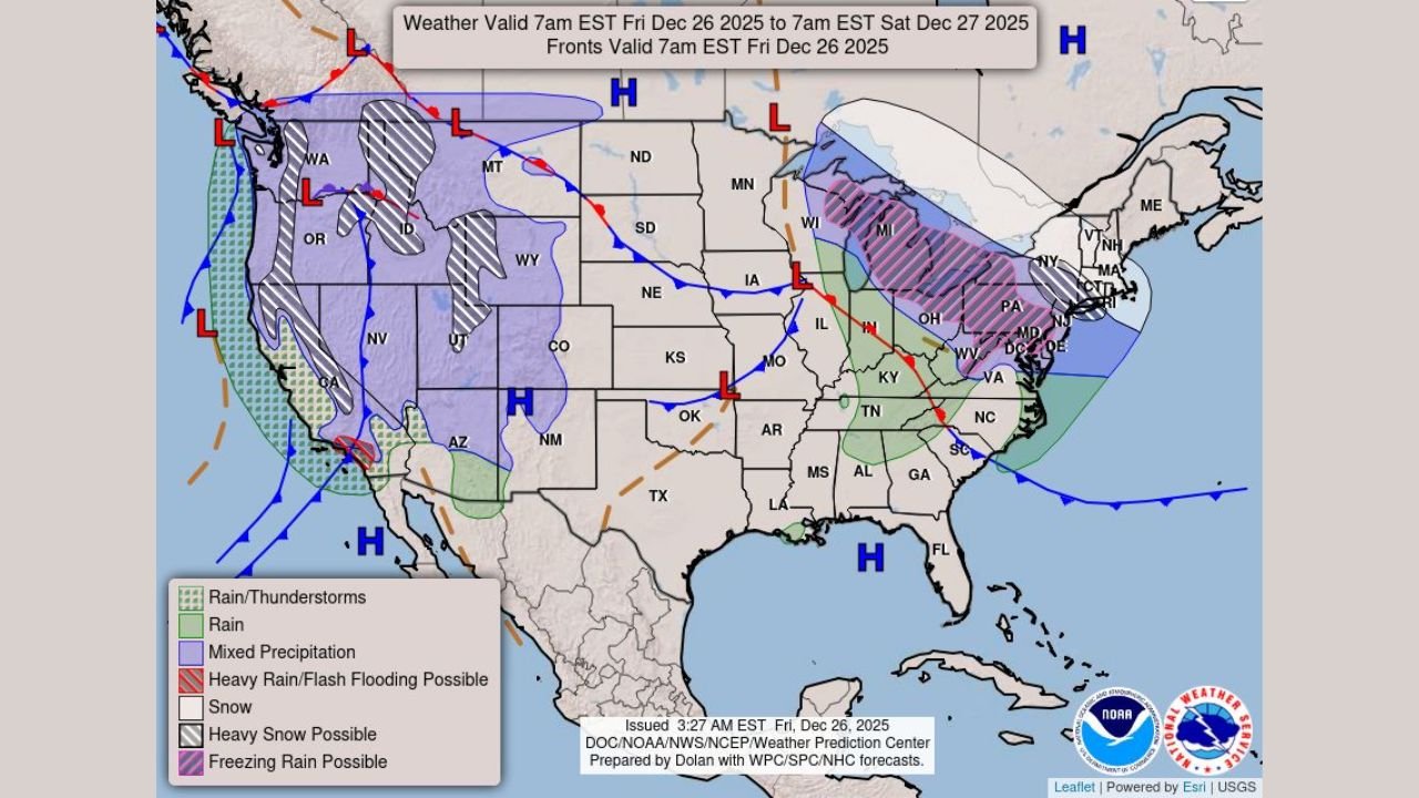
UNITED STATES — A broad winter weather system is creating hazardous travel conditions across the Great Lakes, northern Mid-Atlantic, and southern New England, where a wintry mix of freezing rain, sleet, and snow is expected to persist through Saturday morning, increasing the risk of ice-related power outages and tree damage.
Forecasters warn that this setup is particularly concerning due to ice accumulation combined with gusty winds, which can place added stress on power lines and trees.
Freezing Rain and Sleet Drive the Greatest Risk
The most significant impacts are expected in areas where freezing rain and sleet dominate, especially across portions of:
- The Great Lakes region
- The northern Mid-Atlantic
- Southern New England
In these zones, surface temperatures remain near or below freezing while warmer air moves overhead, creating ideal conditions for ice accretion on roads, trees, and power lines. Even light ice accumulation can result in dangerous driving conditions, while heavier pockets increase the likelihood of downed trees and localized power outages.
Snow Adds to Travel Hazards in Colder Areas
Farther north and inland, colder air allows snow to mix in or briefly dominate, particularly across higher elevations and northern sections of the Great Lakes and New England.
Snowfall, combined with sleet and freezing rain, will lead to:
- Rapidly changing road conditions
- Reduced visibility
- Slippery surfaces that complicate travel and emergency response
Travel conditions may deteriorate quickly, especially overnight when temperatures drop further.
Power Outage and Tree Damage Concerns
One of the primary concerns with this system is the potential for ice-coated trees and power lines, which become more vulnerable when winds increase.
Forecasters note that isolated power outages are possible, particularly in areas that receive:
- Prolonged freezing rain
- Repeated rounds of sleet and snow
- Gusty winds during peak icing
Residents are urged to prepare for possible disruptions by charging devices and limiting unnecessary travel.
Timing and Duration
The most impactful period is expected to occur from Friday into early Saturday, with conditions gradually improving later Saturday morning as temperatures rise and precipitation tapers off.
However, lingering icy spots may persist even after precipitation ends, especially on untreated roads, bridges, and overpasses.
What Residents Should Expect
Across the Great Lakes, northern Mid-Atlantic, and southern New England, residents should be prepared for:
- Icy roads and hazardous travel
- Delays and cancellations
- Localized power outages
- Tree damage in ice-prone areas
Monitoring local advisories and weather updates is strongly recommended.
WaldronNews.com will continue tracking this developing winter weather threat and provide updates as conditions evolve.