
Guthrie and Seymour, Texas Storm Turns Sky Green Before DVD-Sized Hail, EF2 Tornado and 106 MPH Winds Strike on April 29
GUTHRIE, TEXAS — Dramatic images captured near Guthrie on April 29, 2025 show the sky turning an eerie shade of green just before a powerful severe thunderstorm unleashed giant hail, an EF2 tornado near Seymour, and destructive straight-line winds measured up to 106 mph.
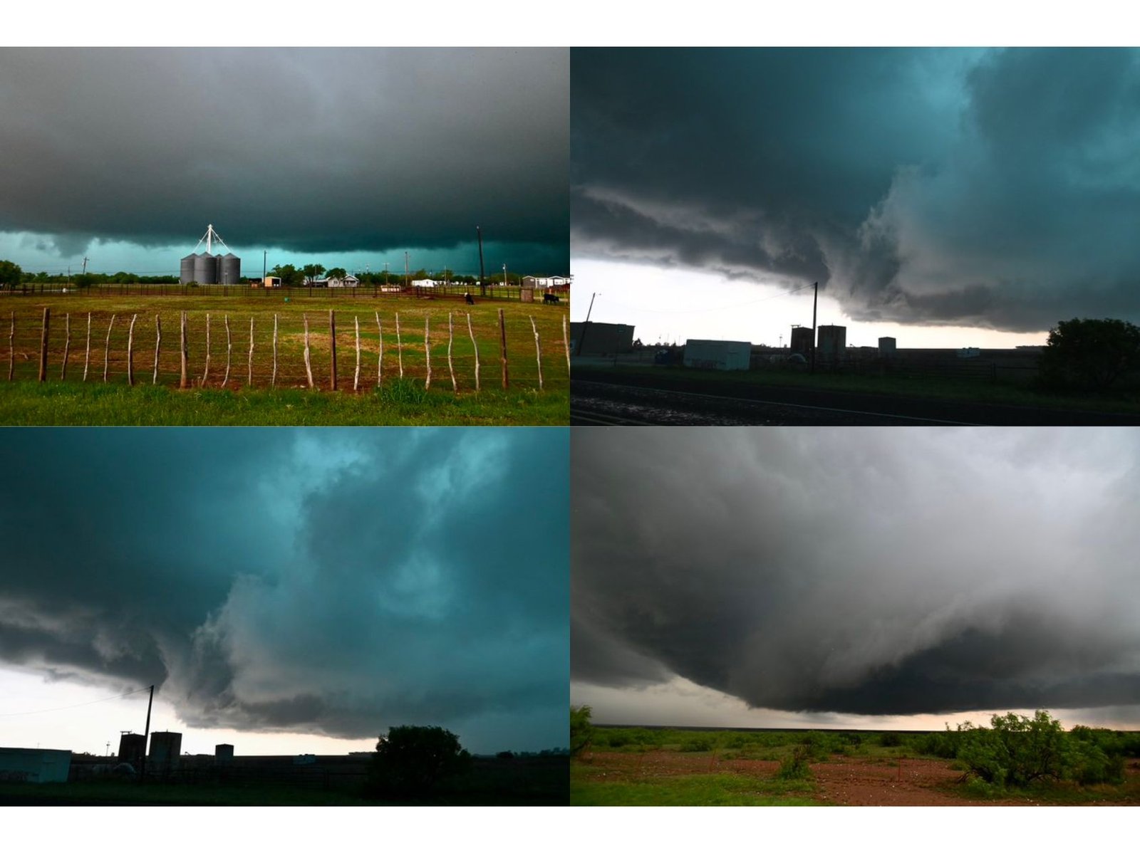
The photos — taken before and after the core of the storm moved through — highlight a phenomenon many Texans have witnessed but few fully understand: the sudden green glow that sometimes precedes the most intense thunderstorms.
A Dangerous Storm Unfolds Across Northwest Texas
The storm system intensified rapidly across northwest Texas, producing:
- Hailstones reportedly the size of DVDs
- An EF2 tornado near Seymour, Texas
- Straight-line wind gusts up to 106 mph
The storm structure visible in the images shows a deep, rotating supercell base with heavy precipitation wrapping around the core. In several frames, the underside of the cloud deck takes on a vivid turquoise and green hue — especially toward the western horizon.
While the green sky often sparks immediate tornado fears, meteorologists emphasize that the color itself is not caused by rotation.
Why the Sky Turns Green Before Severe Storms
The green sky phenomenon is real — and it is most commonly associated with extremely intense thunderstorms, particularly those capable of producing large hail.
Here’s what happens:
- Late in the afternoon, sunlight becomes naturally more yellow and red as the sun lowers toward the horizon.
- That lower-angle sunlight must pass through more of the atmosphere, scattering shorter blue wavelengths.
- Meanwhile, tall thunderstorm clouds — especially those packed with heavy rain and hail — scatter blue and bluish-green light downward.
When the yellow/red light from the setting sun overlaps with blue light scattered by deep storm clouds, the combined effect can produce a green appearance.
In storms loaded with hail, the effect is often stronger because hail cores are associated with exceptionally deep and dense cloud structures.
Not a Tornado Indicator — But a Warning Sign
Importantly, the green sky does not mean a tornado is occurring. Instead, it often signals:
- A very deep storm
- Intense precipitation
- Significant hail potential
In this case, the storm did produce an EF2 tornado near Seymour, but the green coloration itself was tied to storm depth and precipitation — not directly to rotation.
Timing Matters
Most severe thunderstorms peak in the late afternoon or early evening — typically two to three hours before sunset. That timing is critical.
With the sun lower in the sky, its light enters the storm at an angle, increasing the contrast and enhancing unusual color effects. The combination of deep storm clouds and angled sunlight is what creates the striking emerald glow seen in the Guthrie images.
The Bottom Line
The April 29 northwest Texas storm delivered destructive hail, a confirmed EF2 tornado near Seymour, and wind gusts over 100 mph — and it also showcased one of nature’s most dramatic atmospheric visuals.
When yellow sunlight meets blue-scattered storm light, the sky can turn green.
It’s not a tornado trigger — but it often signals a storm strong enough to demand immediate attention.
Stay with WaldronNews.com for continued severe weather coverage and in-depth explanations of the science behind the storms.