
Heavy Snow Band Slams Wake County, North Carolina as Raleigh, Durham, and Surrounding Towns Quickly Pile Up Inches
WAKE COUNTY, NORTH CAROLINA — A long-anticipated band of heavier snow moved directly over Wake County late Saturday night, rapidly increasing snowfall rates across Raleigh, Cary, Apex, Garner, Morrisville, and Wake Forest, with several inches accumulating in a short period of time.
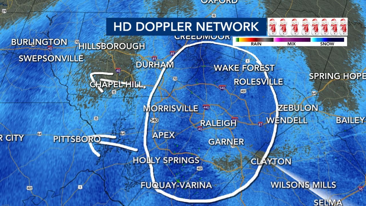
Radar imagery confirms that this is the core snow band forecasters had been watching, capable of laying down multiple inches quickly before gradually shifting east. Travel conditions deteriorated fast as snowfall intensified, especially on untreated roads.
Snowfall Intensifies Across the Triangle
As the snow band settled over central North Carolina, snowfall rates increased significantly, allowing totals to climb rapidly across Wake County and nearby areas.
Preliminary snowfall reports across the region include:
- Roxboro: around 7.5 inches
- Rocky Mount: near 7 inches
- Wilson: approximately 6 inches
- Goldsboro: around 5.5 inches
- Sanford: near 5 inches
- Clayton: around 4.5 inches
- Durham: generally 2 to 4 inches
- Raleigh: roughly 1 to 2.5 inches so far, with additional snow falling
Officials note that totals will vary sharply over short distances, depending on how long the heavier snow band remains overhead.
Why Snow Totals Are Rising So Quickly
Meteorologists explain that this system is producing narrow but intense snowfall bands, which can dramatically increase totals in localized areas. When one of these bands stalls, snowfall accumulates far faster than expected from lighter, steady snow.
This is exactly what occurred across Wake County, where radar showed a persistent, well-organized snow band setting up over the Triangle.
Travel Conditions Continue to Worsen
As snow continues to fall:
- Roads are becoming snow-covered and slick
- Visibility is reduced during heavier bursts
- Travel is becoming increasingly difficult, especially on secondary roads
Officials strongly urge residents to avoid unnecessary travel, as conditions may worsen quickly with little warning.
Community Snow Reports Encouraged
Local weather officials are asking residents to submit snowfall measurements with photo proof and a ruler, which helps improve real-time snow maps and forecasts. These reports are especially important during banded snow events, where conditions can vary dramatically from one neighborhood to the next.
What to Expect Next
The heavier snow band is expected to gradually shift east, but additional accumulation is still possible across Wake County before snow tapers off. Even once snowfall ends, road conditions may remain hazardous overnight, especially as temperatures stay cold.
Residents should prepare for:
- Continued slick and snow-covered roads
- Difficult overnight and early-morning travel
- Delays and disruptions into Sunday
Bottom Line
Wake County is experiencing one of the most impactful snow periods of the winter, as a focused heavy snow band drops inches quickly across the Triangle. While totals will vary, some locations will see significant accumulations in a short window, making travel dangerous and conditions slow to improve.
How much snow has fallen in your area? Share your measurements and stay with WaldronNews for continuing updates as this winter storm moves across North Carolina.