
Heavy Snowfall Expected Across Northern Michigan as Wintry Mix Transitions to 1–2 Inch-Per-Hour Snow Rates Overnight Into Monday Morning
NORTHERN MICHIGAN — A rapidly intensifying winter storm is expected to bring dangerous travel conditions across northern Michigan late Sunday night into Monday morning, as a wintry mix of rain, freezing rain, and sleet transitions to heavy snow across the region. Forecasters warn that snowfall rates of 1 to 2 inches per hour or higher could develop, leading to quick accumulations, very low visibility, and hazardous road conditions.
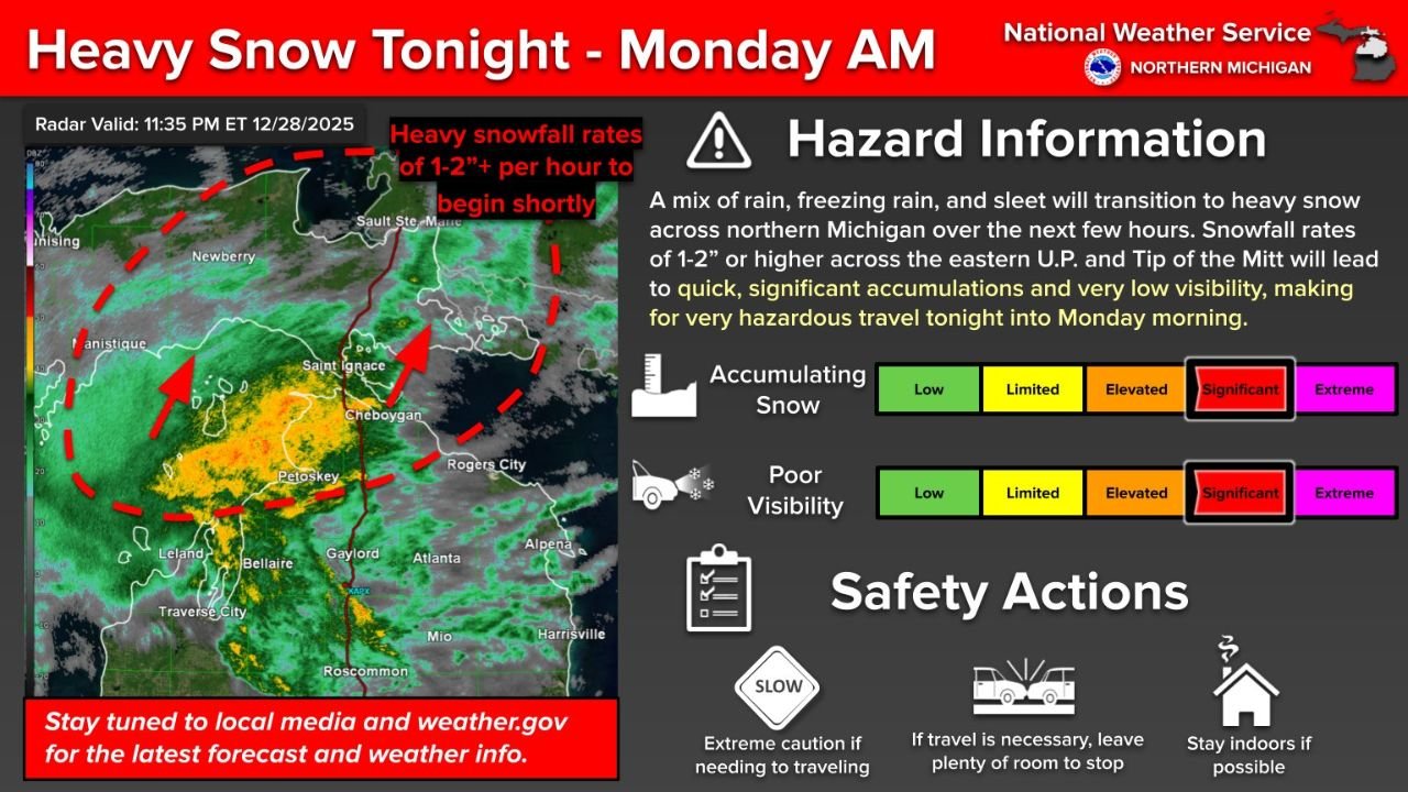
Heavy Snow Bands Developing Overnight
According to the latest update issued late Sunday evening, bands of heavier precipitation are organizing and moving across northern Michigan, particularly affecting the eastern Upper Peninsula and the Tip of the Mitt region. As colder air deepens, precipitation is expected to change fully to snow over the next several hours, with snowfall rates rapidly increasing.
Meteorologists note that these intense snow bands will be capable of producing near whiteout conditions, especially in areas where snowfall becomes persistent.
Most Impacted Areas
The highest impacts are expected in:
- Eastern Upper Peninsula
- Tip of the Mitt
- Surrounding northern Lower Michigan communities
These areas are most likely to experience 1–2 inches of snow per hour, which can overwhelm road crews and cause rapid deterioration of driving conditions.
Visibility and Travel Conditions
As snowfall intensifies:
- Visibility may drop sharply, especially during heavier bursts
- Road surfaces will quickly become snow-covered
- Travel may become very difficult to impossible at times
Officials stress that hazardous travel conditions are expected to continue overnight and into Monday morning, particularly during the early commute hours.
Safety Guidance for Residents
Authorities urge residents across northern Michigan to take this storm seriously and follow safety precautions:
- Avoid unnecessary travel overnight
- If travel is required, drive slowly and allow extra stopping distance
- Keep an emergency winter kit in vehicles
- Stay informed through local media and official weather updates
The combination of heavy snowfall, low visibility, and rapid accumulation significantly increases the risk of accidents and road closures.
What Happens Next
Heavy snow is expected to continue through the overnight hours, with conditions gradually improving later Monday morning as snowfall rates decrease. However, lingering snow-covered roads may still pose challenges even after the heaviest snow ends.
What are you seeing in your area tonight? Are roads already becoming difficult to travel? Share your local conditions and stay connected with ongoing weather coverage at WaldronNews.com.