
Maryland, Virginia, and Washington, D.C. Could See Freezing Rain, Sleet, or Snow as Cold Air and Storm System Collide Friday
MID-ATLANTIC — A developing winter weather pattern could bring freezing rain, sleet, and possible snow to parts of Maryland, Virginia, and the Washington, D.C. metro area late Friday into early Saturday, as a surge of cold air down the East Coast coincides with an approaching storm system from the west.
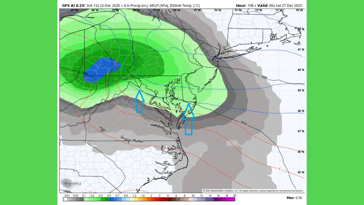
Forecast data shows temperatures struggling to rise above freezing across much of the Mid-Atlantic, creating conditions favorable for dangerous wintry precipitation, especially during the initial phase of the storm.
Most Impacted Areas Identified by Forecast Data
Based on the latest model guidance, the highest-impact zone currently includes:
- Central and northern Virginia
- Central and southern Maryland
- The I-95 corridor, including Baltimore and Washington, D.C.
These areas are most likely to remain near or below freezing while precipitation moves in, increasing the risk of ice accumulation and travel disruptions.
Freezing Rain and Sleet Pose Main Threat
Forecast maps show freezing rain as the primary concern, particularly across central Virginia into southern and central Maryland. Even light ice accumulation can lead to slick roadways, hazardous driving conditions, and isolated power outages, especially if ice builds on trees and power lines.
Sleet is also possible in the same region, which can further worsen travel conditions by creating a hard, icy surface that is difficult to treat.
Snow Possible in Colder Locations
On the colder northern edge of the system, snow is possible in parts of northern Maryland and higher elevations of Virginia. Some guidance suggests the Baltimore metro area could briefly see snow if temperatures remain cold enough throughout the atmosphere, particularly at higher elevations.
However, confidence in snow totals remains low, and small temperature changes could quickly shift precipitation back to ice or rain.
Why Forecast Confidence Is Still Limited
This storm setup involves tight temperature margins, meaning minor shifts in the storm track or timing of cold air could significantly change outcomes. Models continue to fluctuate between ice-dominant and mixed-precipitation scenarios, and final impacts will depend on how quickly cold air deepens as precipitation arrives.
What Residents Should Do Now
Residents across Maryland, Virginia, and Washington, D.C. should closely monitor forecast updates through the week, especially those with Friday travel plans. Even if snowfall remains limited, freezing rain and sleet can cause serious disruptions with little warning.
WaldronNews.com will continue tracking this developing winter weather threat and provide updates as confidence improves and details become clearer.