
Maryland, Virginia, West Virginia, and Washington, D.C. Brace for Dangerous Overnight Cold as Wind Chills Drop to −5°F to −25°F
UNITED STATES — A dangerously cold Arctic air mass is settling across parts of the Mid-Atlantic and central Appalachians, prompting cold weather alerts from Monday evening through Tuesday morning and raising serious concerns about frostbite and hypothermia exposure.
Cold Weather Advisories, Extreme Cold Watches, and Extreme Cold Warnings are in effect from 7 PM Monday until 11 AM Tuesday, covering much of Maryland, northern and central Virginia, eastern West Virginia, and the Washington, D.C. metro area.
Wind Chills Plunge Well Below Zero
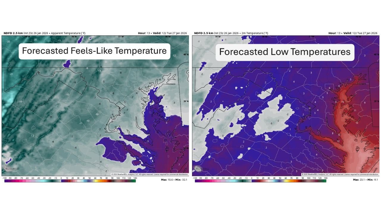
Forecast data shows feels-like temperatures ranging from −5°F to as cold as −25°F, especially in higher elevations and exposed areas.
Actual overnight low temperatures are expected to fall:
- Just below zero in colder inland and elevated locations
- Into the low to mid single digits across much of the region
These conditions create an environment where frostbite can occur in as little as 10–30 minutes on exposed skin.
Most Severe Cold Focused West and North
The coldest conditions are expected across:
- Eastern West Virginia, where Extreme Cold Warnings are in effect
- Western and northern Maryland, including higher terrain
- Northern Virginia, particularly away from urban heat centers
Areas closer to the Chesapeake Bay and coastal zones will still experience dangerous cold, though slightly moderated compared to inland locations.
Why This Cold Is Especially Dangerous
This is not just a cold night — it is a wind-driven cold event. Strong winds dramatically reduce effective temperatures, accelerating heat loss from the body.
Key risks include:
- Rapid onset frostbite
- Hypothermia if precautions are not taken
- Increased danger for unhoused populations, pets, and those without adequate heating
Officials strongly advise limiting time outdoors, wearing multiple layers, and ensuring pets are brought indoors overnight.
Timing Breakdown
- Cold alerts begin: 7 PM Monday
- Coldest conditions: Late Monday night through early Tuesday morning
- Alerts expire: 11 AM Tuesday
Temperatures will slowly recover after sunrise Tuesday, but cold conditions will persist through the day.
Bottom Line
This is a high-confidence, high-impact cold event for the Mid-Atlantic region. While snow is not the main concern, the life-threatening wind chills make this a serious weather situation requiring caution and preparation.
Stay with WaldronNews.com for continued updates on cold alerts, school or government closures, and when safer temperatures are expected to return.