
Massive Pacific Storm Spins Off California and Oregon Coast, Fueling Blizzard Setup for New York, New Jersey and New England
UNITED STATES — A gigantic Pacific storm swirling off the West Coast is drawing attention from meteorologists, not just for its size near California and Oregon, but for how it may be helping set the stage for a powerful blizzard threat across the Northeast.
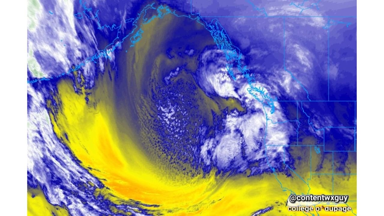
Satellite imagery shows a massive, tightly wound storm system spinning in the eastern Pacific, west of California, Oregon, and Washington, with a deep plume of moisture arcing southward and then curving inland toward the western United States. The storm’s structure suggests a strong upper-level disturbance embedded within an active Pacific jet stream.
Aleutian Ridge and Pacific Energy Driving the Pattern
Forecasters point to a pronounced ridge near the Aleutian Islands of Alaska that helped “birth” this system. When energy dives south from the Gulf of Alaska and interacts with the Pacific jet, it can amplify downstream weather across the continental United States.
In this case, the large Pacific storm appears to be reinforcing a deep trough over the central and eastern U.S. — a setup that favors:
- Colder air plunging into the Midwest and Northeast
- Strong coastal storm development along the Atlantic
- Enhanced snowfall potential from the Mid-Atlantic into New England
Why the East Coast Storm Strengthened
Earlier model guidance had struggled to fully capture the intensity of the developing East Coast storm. Meteorologists now suggest that the Pacific system’s influence — particularly its energy injection into the jet stream — may have been underrepresented in some forecast runs.
As the Pacific storm pumped momentum into the upper-level flow, it helped sharpen the temperature gradient across the eastern half of the country. That contrast between Arctic air and Atlantic moisture is prime fuel for nor’easter development.
West Coast Impact: Heavy Rain, Mountain Snow, and Rough Seas
While much of the focus has shifted to the Northeast blizzard threat, the Pacific system itself is a major player for the West Coast.
Impacts likely include:
- Heavy coastal rain in northern California and southern Oregon
- Significant mountain snow in the Sierra Nevada and Cascades
- Strong winds and high surf along the Pacific shoreline
The satellite view shows a broad moisture shield aimed toward the West Coast, suggesting continued unsettled weather before the energy shifts inland.
The Bigger Picture
This coast-to-coast interaction highlights how interconnected U.S. weather patterns can be. A storm spinning hundreds of miles off California can ultimately influence snow totals in New York, New Jersey, Connecticut, Rhode Island, and Massachusetts days later.
If the pattern holds, the East Coast could see blizzard conditions and significant snowfall, while the West continues to deal with Pacific-driven storms.
Stay with Waldronnews.com as we continue tracking how this massive Pacific system reshapes weather from the West Coast to the Northeast.