
Moisture Surge from Gulf of Mexico to Bring Rain Showers Across Texas, Louisiana, and Gulf Coast States
Houston, Texas — A broad plume of Gulf moisture is pushing northward toward the U.S. Gulf Coast, setting the stage for scattered rain showers and rising humidity across Texas, Louisiana, and parts of the Deep South today. Meteorologists say this system, rich in “predictable water,” will slide close enough to the shoreline to trigger on-and-off rainfall through the afternoon and evening.
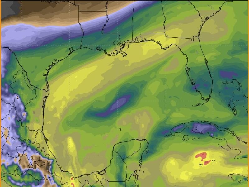
Moisture Increases Along the Gulf Coast
Satellite and model data early Wednesday show a thick band of atmospheric moisture extending from the western Gulf of Mexico toward Houston, Lake Charles, and New Orleans. The feature, marked by a bright yellow plume on water vapor imagery, is steadily advancing north.
As this moisture interacts with weak lift in the atmosphere, light to moderate rain showers will develop along the coastal plain. The National Weather Service says rainfall will be most widespread across southeast Texas and southern Louisiana, where isolated heavier pockets could briefly cause ponding on roads.
Texas and Louisiana to See Intermittent Showers
Residents in Houston, Beaumont, and Baton Rouge can expect increasing clouds and spotty rain by midday. Inland areas across eastern Texas and southwestern Mississippi may also experience brief showers later in the day as the moisture plume spreads north.
While rainfall totals are not expected to be significant, forecasters say the system’s slow northward drift will keep conditions damp and humid, especially near the coast.
No Severe Weather Expected, But Wet Commute Possible
Forecasters emphasize that the storms associated with this pattern will not be severe, but drivers should prepare for wet roadways and reduced visibility during the morning and evening commutes. The moisture influx may also cause patchy fog overnight, particularly near the coast.
Temperatures will remain mild, with highs ranging from the mid-60s in southeast Texas to the low 70s in southern Louisiana, thanks to the warm southerly flow from the Gulf.
Outlook for the Coming Days
By Thursday, the core of the moisture will lift northeast toward Mississippi, Alabama, and the Florida Panhandle, where additional rounds of rain are likely. Another surge of Gulf moisture is expected to follow later in the week, continuing a wet pattern for much of the region.
Meteorologists say this setup could mark the beginning of a more active period for the Gulf Coast as winter systems from the west interact with warm, humid air from the Gulf of Mexico.
For continuing updates on developing Gulf weather and rainfall forecasts, follow WaldronNews.com for the latest verified reports and regional advisories.
Author: Colton Hayes Category: Weather