
New England, Maryland, Pennsylvania Face Snow Chances and Dangerous Cold as Arctic Blast Hits Friday Through Sunday
NEW ENGLAND — A sharp Arctic air mass is set to surge into the Northeast and Mid-Atlantic late this week, bringing periods of light snow, ocean-effect bands, and the coldest temperatures of the season across parts of Massachusetts, Connecticut, Rhode Island, Maine, New Hampshire, Vermont, Maryland, and Pennsylvania.
Forecast models show a wintry stretch from Friday into Sunday, with snow chances increasing ahead of an intense cold outbreak that will make Sunday a strong contender for the coldest day of the winter so far across much of the region.
Snow Potential Friday Into Saturday Across New England
High-resolution guidance, including the NAM 3 km, indicates ocean-effect snow developing Friday, driven by a north-northeast wind flow off the Atlantic into very cold air. This setup favors localized snow showers, especially along coastal sections of Massachusetts and Rhode Island, with lighter activity extending inland.
Snow amounts in most New England locations appear light and spotty, but even small accumulations could impact travel due to sub-freezing temperatures and untreated roads. Additional scattered snow showers may linger into Saturday, keeping conditions wintry through the weekend.
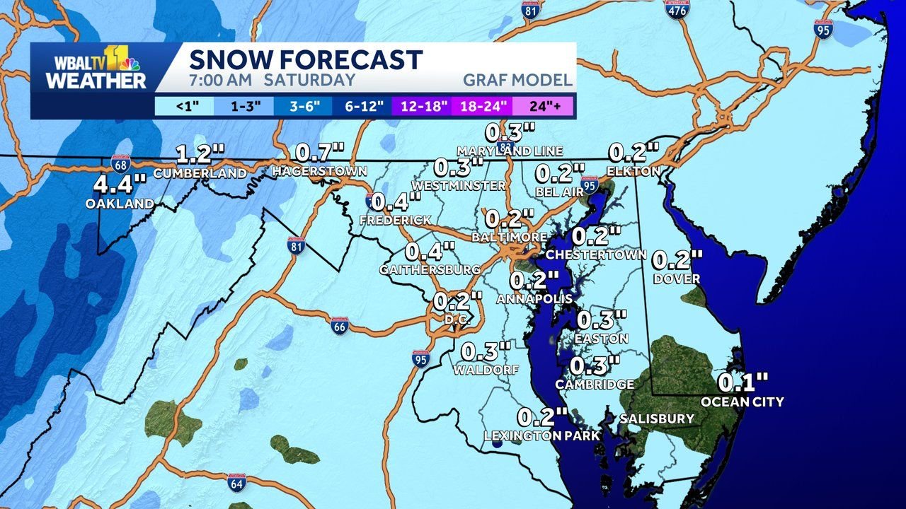
Western Maryland Snow Heaviest, Lighter Near Baltimore
Snow potential becomes more notable in western Maryland, where forecast data suggests 4 inches or more of snow between Friday morning and early Saturday. Areas near Oakland and the higher elevations of Garrett County are most favored for accumulation.
Farther east, including Baltimore, Annapolis, and central Maryland, snow is expected to be much lighter, generally a coating to under an inch, mainly Friday evening. While amounts are limited, slick roads are possible during the evening commute, as temperatures remain below freezing.
Bitter Cold Peaks Saturday Night Into Sunday Morning
Behind the snow chances, an Arctic blast will overspread the entire region. Forecast wind chill maps show feels-like temperatures ranging from -15°F to -30°F, particularly late Saturday night into Sunday morning.
This cold air mass is expected to affect New England, eastern Pennsylvania, New Jersey, and Maryland, with actual temperatures running 20 to 30 degrees below seasonal averages. Sunday morning is shaping up to be the most uncomfortable period, with dangerous wind chills persisting through the early hours.
Cold Is Brief but Intense
The good news is that guidance suggests this will be a fast-moving cold snap, not a prolonged freeze. Temperatures are expected to gradually moderate early next week as the Arctic air retreats.
Still, officials advise residents to limit time outdoors, dress in layers, protect pets, and use caution on roads where light snow and extreme cold combine.
What are you seeing in your area — snow showers, icy roads, or extreme cold?
Share your local conditions and stay updated with the latest regional weather coverage at WaldronNews.com.