
New England Winter Weekend Ahead as Maine, Massachusetts, New Hampshire and Vermont Face Snow and Dangerous Cold
NEW ENGLAND — Forecast models are increasingly pointing toward a wintry and potentially hazardous weekend across Maine, Massachusetts, New Hampshire, Vermont, Connecticut, and Rhode Island, as a surge of Arctic air combines with ocean-enhanced snowfall chances from Friday into Sunday.
While snowfall amounts appear mostly light and scattered, the combination of snow showers, bitter cold, and sub-zero wind chills could create difficult travel conditions and elevated cold-weather risks across the region.
Ocean-Effect Snow Possible Friday as Arctic Air Arrives
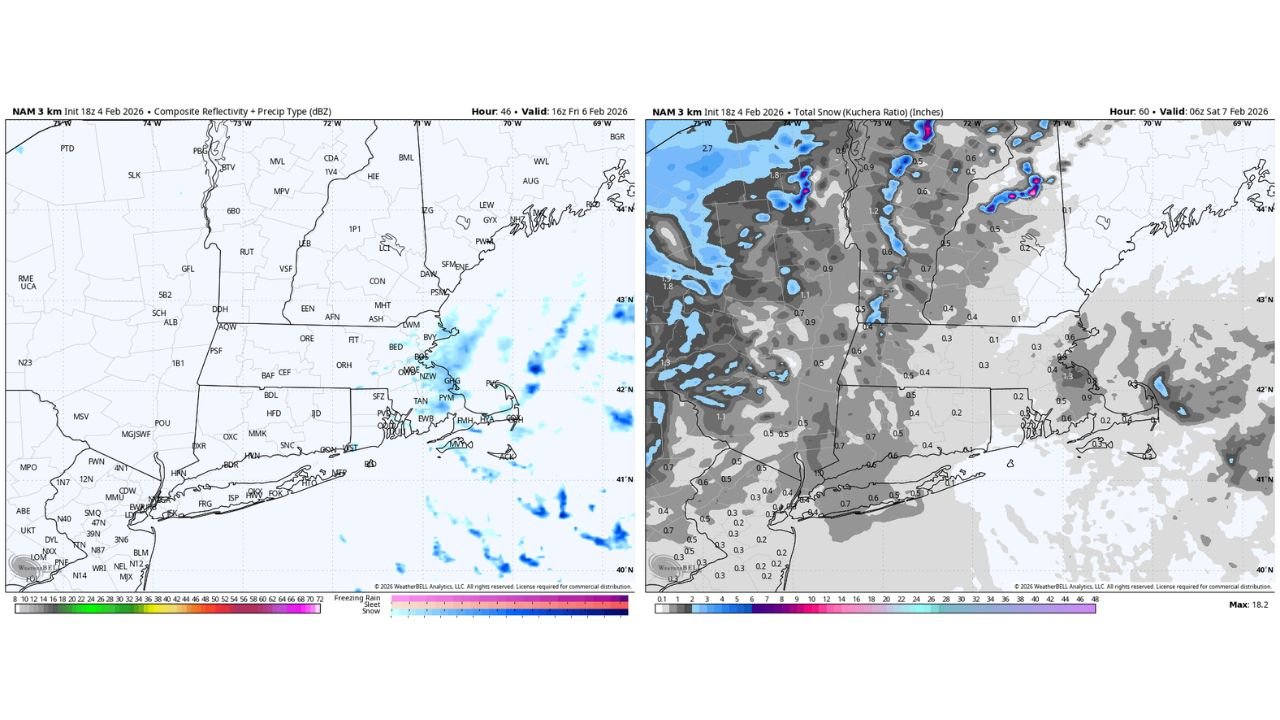
High-resolution NAM guidance is indicating the potential for ocean-effect snow bands developing Friday, particularly across eastern Massachusetts, coastal New Hampshire, southern Maine, and parts of Rhode Island.
This setup develops as a north-northeast (NNE) flow pulls cold Arctic air over relatively warmer ocean waters, allowing narrow but persistent snow showers to form. While this is not expected to be a widespread snowstorm, localized areas could see periodic snow bursts, especially near the coast and higher terrain.
Snowfall totals from this phase generally remain under one inch, though isolated spots could briefly pick up higher amounts if bands linger.
Additional Snow Chances Continue into Saturday
Snow potential does not end Friday. Model data suggests intermittent light snow or flurries may persist into Saturday, particularly across central and northern New England, including Vermont, New Hampshire, and interior Maine.
These snow showers appear tied to upper-level disturbances and inverted trough features, which are notoriously difficult to pin down in exact placement. Because of this uncertainty, forecasters caution that some locations could experience plowable snowfall, even if most areas only receive minor accumulations.
Sunday May Be the Coldest Day of the Season Across the Northeast
The most significant impact of the weekend looks to arrive on Sunday, which is shaping up to be a strong contender for the coldest day of the season across much of the Northeast.
Forecast wind chill maps show feels-like temperatures dropping well below zero across all six New England states, with some northern areas experiencing wind chills of –20°F to –35°F.
Actual air temperatures are expected to run 20 to 30 degrees below seasonal averages, driven by a direct Arctic air mass spilling southward behind the frontal system.
Dangerous Wind Chills and Exposure Risks
Strong winds accompanying the Arctic outbreak will significantly worsen conditions, especially during the day Sunday. Even areas near the coast, including Boston, Portland, and coastal Connecticut, could experience single-digit temperatures with sub-zero wind chills.
These conditions pose risks for:
- Frostbite in as little as 10–30 minutes
- Hypothermia during prolonged outdoor exposure
- Icy roads and reduced visibility during snow showers
Residents are urged to limit time outdoors, dress in layers, and ensure pets and vulnerable individuals are protected from the cold.
Wintry Pattern Continues, But Timing Still Uncertain
While confidence is high in the cold, confidence in exact snow placement remains lower, especially with small-scale features like ocean-effect snow and inverted troughs. Forecast details will likely evolve as higher-resolution data becomes available closer to the weekend.
What is clear, however, is that New England is facing a distinctly wintry stretch, marked by light snow potential and the harshest cold of the season so far.
Stay with WaldronNews.com for continued updates on snowfall timing, cold-weather impacts, and any advisories issued across New England. If you’re in the region, how are you preparing for the cold and snow this weekend? Share your thoughts and experiences with us.