
New Storm Zone Alert Highlights Northeast Kansas and Southeast Nebraska Risk Area So Residents Should Watch For High Based Severe Storms Thursday
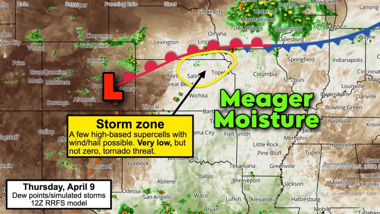
UNITED STATES — A new localized storm setup is emerging for Thursday, focusing on a narrow but important corridor across northeastern Kansas and extreme southeastern Nebraska, where atmospheric conditions may support isolated severe thunderstorms.
Unlike larger widespread outbreaks, this setup is more limited in coverage but still carries specific risks that residents in the highlighted zone should not ignore.
Focus Area Centered Near Topeka and Surrounding Regions
The primary zone of concern is centered around:
- Northeastern Kansas including Topeka
- Areas near Salina and surrounding central Kansas regions
- Extreme southeastern Nebraska
This region sits along a frontal boundary where conditions may briefly become favorable for storm development.
High Based Storms Expected Due to Limited Moisture
One of the defining characteristics of this setup is meager moisture across the region.
Because of this:
- Storms are expected to be high-based, meaning they form higher above the ground
- This reduces the efficiency of tornado formation
- However, storms can still produce strong impacts aloft
This type of setup often leads to storms that look less intense at the surface but still carry hazards.
Wind and Hail Are the Main Threats
Even with limited moisture, the environment can still support:
- Strong to severe wind gusts
- Hail-producing thunderstorms
- Isolated strong storm cores
The elevated nature of storms can enhance downdraft winds, increasing the risk of sudden strong gusts at the surface.
Tornado Risk Is Very Low but Not Zero
While the tornado threat is significantly limited, it is not completely ruled out.
Key points include:
- Lack of deep moisture reduces tornado potential
- Any rotation that develops is likely to remain elevated
- A brief or weak tornado cannot be fully excluded
This makes the situation one that requires awareness, even if the overall tornado risk remains low.
Storm Development Timeline
Storm activity is expected to develop during Thursday, April 9, with:
- Initial storm formation during the afternoon
- Potential peak intensity in the late afternoon to evening
- Gradual weakening after sunset
The timing suggests a short window where conditions briefly align for stronger storms.
Why This Setup Still Matters
Even though this is not a major outbreak scenario, localized severe weather events can still cause:
- Sudden wind damage
- Isolated hail impacts
- Rapidly changing conditions for outdoor activities
The limited coverage also means storms could be more unpredictable in placement.
Final Outlook
This developing Thursday setup highlights a targeted storm zone across northeastern Kansas and southeastern Nebraska, where a few high-based supercells could develop despite limited moisture.
Residents in and around Topeka and nearby regions should stay alert for changing weather conditions, especially during the afternoon and evening hours.
Stay connected with WaldronNews.com for further updates as this localized severe weather risk continues to evolve.