
New York Endures Another Frigid Day as Central Park Stays Far Below Normal, With Gradual Warm-Up Expected Next Week
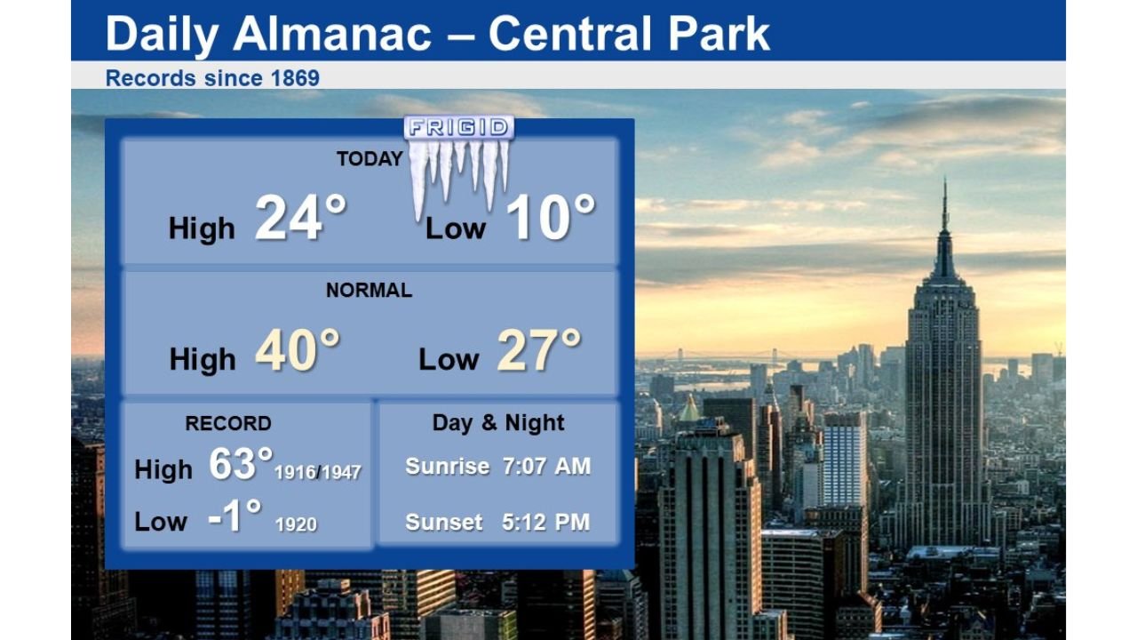
NEW YORK, NEW YORK — The stretch of bitter winter cold continued across New York City on Saturday, with Central Park recording a high of just 24°F and a morning low of 10°F, well below late-January averages. While the cold remained firmly in place through the weekend, forecasters say temperatures will slowly moderate as the new workweek begins.
Data from the National Weather Service office in New York shows the city spent the day running 15 to 20 degrees colder than normal, reinforcing how entrenched the cold air mass remains across the Northeast.
Central Park Temperatures Well Below Seasonal Normals
Saturday’s readings highlight just how sharp the cold has been:
- Observed high: 24°F
- Observed low: 10°F
- Normal high: 40°F
- Normal low: 27°F
Despite abundant sunshine at times, temperatures struggled to recover, a sign of the lingering Arctic air that has dominated the region in recent days.
How Saturday Compared to Historic Records
While no records were broken, Saturday’s cold still stood out when placed in historical context. Central Park’s record low for January 31 is −1°F, set in 1920, and the record high is 63°F, last reached in 1916 and again in 1947.
The fact that the city remained more than 15 degrees below normal underscores how persistent this cold pattern has been, even without reaching record extremes.
Cold Pattern Continues Into the Weekend
Forecasters say the frigid air mass will remain in control through the remainder of the weekend, keeping overnight lows in the teens and daytime highs confined to the 20s and lower 30s. Wind chills during the overnight and early morning hours may dip even lower, especially in exposed areas.
Residents are urged to continue taking cold-weather precautions, particularly during the overnight hours when temperatures fall quickly after sunset.
Signs of Relief Early Next Week
There is some encouraging news on the horizon. Meteorologists expect a gradual easing of the cold starting early next week, with temperatures slowly trending upward toward more seasonable levels.
While no sudden warm-up is expected, daytime highs should begin edging closer to the mid-30s and eventually the upper 30s, offering a noticeable improvement from the current deep chill.
What This Means for New Yorkers
For now, residents should plan for:
- Continued cold mornings and evenings
- Icy conditions on untreated surfaces during overnight hours
- Increased heating demand through the weekend
As the cold loosens its grip, conditions should become more manageable heading into the workweek.
Bottom Line
New York City remains locked in a cold late-January pattern, with Central Park temperatures running far below normal. While the worst of the chill has not broken records, it has been persistent and impactful. A slow warm-up early next week should finally bring some relief, though winter conditions are far from over.
How cold did it feel in your neighborhood today? Share your local temperatures and stay with WaldronNews for continued Northeast weather updates.