
Next Wintry Threat Takes Shape for Washington, D.C. as Models Hint at Midweek Snow or Wintry Mix
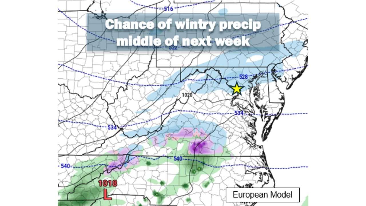
UNITED STATES — With the weekend storm now looking like an almost complete miss aside from gusty winds, forecasters are shifting attention to the next potential wintry system, which computer models suggest could affect the Washington, D.C. area between Tuesday night and Wednesday night next week.
At this point, confidence remains low, but enough signals are appearing in guidance to warrant close monitoring.
What Models Are Showing Right Now
Current model runs depict the midweek system as a weak atmospheric wave rather than a fully developed winter storm. Because the system is still several days out, forecasters stress that it is far too early to determine whether it will strengthen, remain weak, or fizzle out entirely.
Most guidance at the moment suggests limited snowfall potential, generally no more than a few inches, with some model solutions focusing the bulk of accumulating snow south of the D.C. region.
Temperature Setup Still Cold Enough for Snow
Despite slightly warmer air compared to the current Arctic blast, temperatures during the Tuesday–Wednesday window still support wintry precipitation if moisture arrives.
- Nighttime lows: Upper teens to mid-20s
- Daytime highs Wednesday: Around 30°F to mid-30s
That temperature range is cold enough to allow snow or a wintry mix, provided the system produces enough precipitation.
Why Confidence Is Low
Forecasters emphasize that small track changes will matter greatly with this setup. A weaker system could bring little to no impact, while a stronger or better-positioned wave could introduce light accumulating snow, especially during overnight hours.
At this range, model spread remains high, and outcomes are highly sensitive to how the system evolves over the next several days.
Another System Possible Later Next Weekend
Looking even further ahead, models also hint at another chance for snow or wintry precipitation toward next weekend, but meteorologists caution that it is far too early to speculate on impacts or timing for that potential system.
Bottom Line
For now, the midweek Tuesday–Wednesday timeframe is the next period to watch for wintry potential in the Mid-Atlantic, especially around Washington, D.C. While current signals point to a minor event at most, changing model trends could quickly alter the outlook.
Stay with WaldronNews for updated forecasts and model trends as confidence improves over the coming days.