
Norman, Oklahoma Sees 1–2 Inch-Per-Hour Snowfall as Winter Storm Intensifies Near Snow-Sleet Boundary
NORMAN, OKLAHOMA — A significant winter storm is actively impacting Norman, where heavy snow is falling at rates of 1 to 2 inches per hour, according to real-time radar and observational data. The city is positioned very close to the snow-sleet transition zone, making conditions especially volatile as slightly warmer air presses in from the south and east.
Meteorologists monitoring the storm say Norman sits in a high-impact corridor, where intense snowfall is occurring on the cold side of the system while mixed precipitation threatens nearby areas.
What’s happening right now in Norman
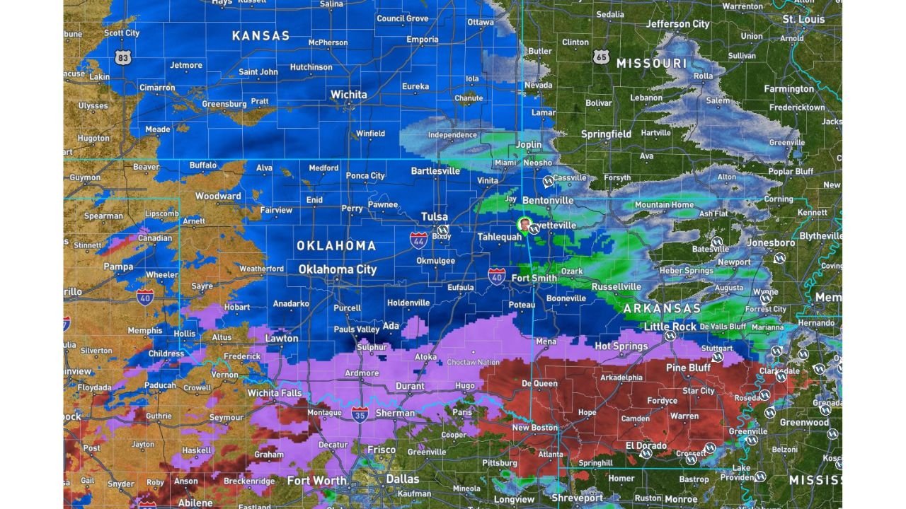
Radar imagery shows a well-defined band of deep blue returns directly over and just north of Norman, signaling heavy, efficient snow production. Some parts of the city and nearby communities have already recorded more than 2 inches of accumulation, with additional snow continuing to fall steadily.
Key factors driving the intensity include:
- Strong lift within the storm core directly over central Oklahoma
- Cold surface temperatures supporting all snow in Norman
- High moisture content fueling rapid accumulation
This combination is allowing snow to pile up quickly, reducing visibility and making travel conditions dangerous.
Snow-sleet line remains a major concern
Norman’s proximity to the snow-sleet boundary is critical. Areas just south and east of the city are experiencing sleet and freezing rain, where warmer air aloft is changing precipitation type. Even a small temperature shift could temporarily mix sleet into the snowfall, increasing the risk of icy road surfaces.
For now, Norman remains cold enough to stay primarily snow — but forecasters warn this balance is delicate.
What to expect through the night and into morning
As the storm continues to evolve:
- Heavy snow is expected to persist overnight
- Moisture will continue filling in from Texas, reinforcing precipitation
- Additional accumulations are likely before snowfall rates gradually ease
If the snow band remains locked in place, totals could climb rapidly in a short period of time.
Impacts for Norman residents
Conditions across Norman are expected to worsen before improving:
- Roads may become snow-covered and slick very quickly
- Visibility could drop sharply during heavier bursts
- Travel overnight and early morning may become hazardous
Residents are urged to limit unnecessary travel and monitor local advisories closely.
Bottom line
Norman is currently experiencing one of the most intense phases of this winter storm, with snowfall rates high enough to cause rapid accumulation in a matter of hours. With the city sitting near a critical precipitation boundary, conditions may fluctuate, but the overall risk remains high as the storm continues.
Stay with WaldronNews for continued Norman-specific updates as new radar data and forecasts become available.