
North Carolina and South Carolina Likely to See Mostly Flurries as Offshore Storm Track Limits Snow Potential
NORTH CAROLINA AND SOUTH CAROLINA — Forecast data continues to suggest that most of the Carolinas will see little more than scattered flurries as a weak winter system passes nearby, with meaningful snow accumulations unlikely unless conditions change offshore. Meteorologists say that for anything more than flurries to materialize, a stronger surface low would need to develop just off the East Coast, allowing colder air to be drawn farther south and west into the region.
At this time, that scenario remains uncertain, keeping snowfall expectations modest across both states.
Why Snow Chances Are Limited Right Now
Current guidance shows the developing low-pressure system remaining too weak and too far offshore to significantly impact inland areas of North Carolina and South Carolina. Without a stronger coastal low, the system lacks the ability to pull deep cold air into the Carolinas.
As a result:
- Moisture remains limited inland
- Cold air is shallow and marginal
- Precipitation struggles to organize beyond light snow showers or flurries
Most forecast models indicate little to no accumulation for the majority of the region.
What Would Need to Change for More Snow
Forecasters note that the setup could look different if the offshore low becomes slightly stronger.
A stronger low would:
- Act more “sucky,” pulling colder air westward from the interior
- Increase lift and moisture availability
- Raise the chance for light accumulating snow, especially in northern or interior sections
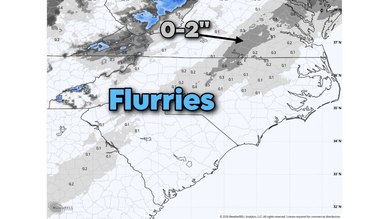
Even in that scenario, projected snowfall would still be limited, generally in the 0–2 inch range, and highly localized.
Where Flurries Are Most Likely
Based on current projections:
- Central and eastern North Carolina: Occasional flurries possible, little accumulation
- Northern South Carolina: Spotty flurries, mainly during colder overnight or morning hours
- Coastal areas: Mostly cold rain or mixed precipitation offshore, with minimal inland impact
Any snow that does fall is expected to be brief and patchy, with roads largely remaining just wet or cold rather than snow-covered.
Cold Air Is the Bigger Story
While snow chances are low, cold air will still be present, keeping temperatures below normal and allowing flurries to form where moisture briefly overlaps with cold air.
Residents may notice:
- Light snowflakes with no accumulation
- Chilly daytime temperatures
- Cold overnight lows that reinforce a wintry feel despite minimal snowfall
Bottom Line for the Carolinas
At this point, North Carolina and South Carolina are not expected to see a significant winter weather event from this system. Flurries remain the most likely outcome, with accumulating snow dependent on a stronger-than-expected offshore storm, which is not currently favored by guidance.
Forecasts will continue to be monitored closely, but unless the coastal low strengthens, the Carolinas should expect more cold than snow from this setup.