
Ohio Weather Alert: Two Rounds of Snow Expected Across Central and Southern Ohio This Week
OHIO — The National Weather Service is warning residents that two separate rounds of snow are expected across Ohio over the next couple of days, bringing light but potentially travel-disrupting accumulations to several communities. The timing and distribution of the snowfall indicate that Wednesday and Wednesday night may produce the most noticeable impacts, especially across central Ohio.
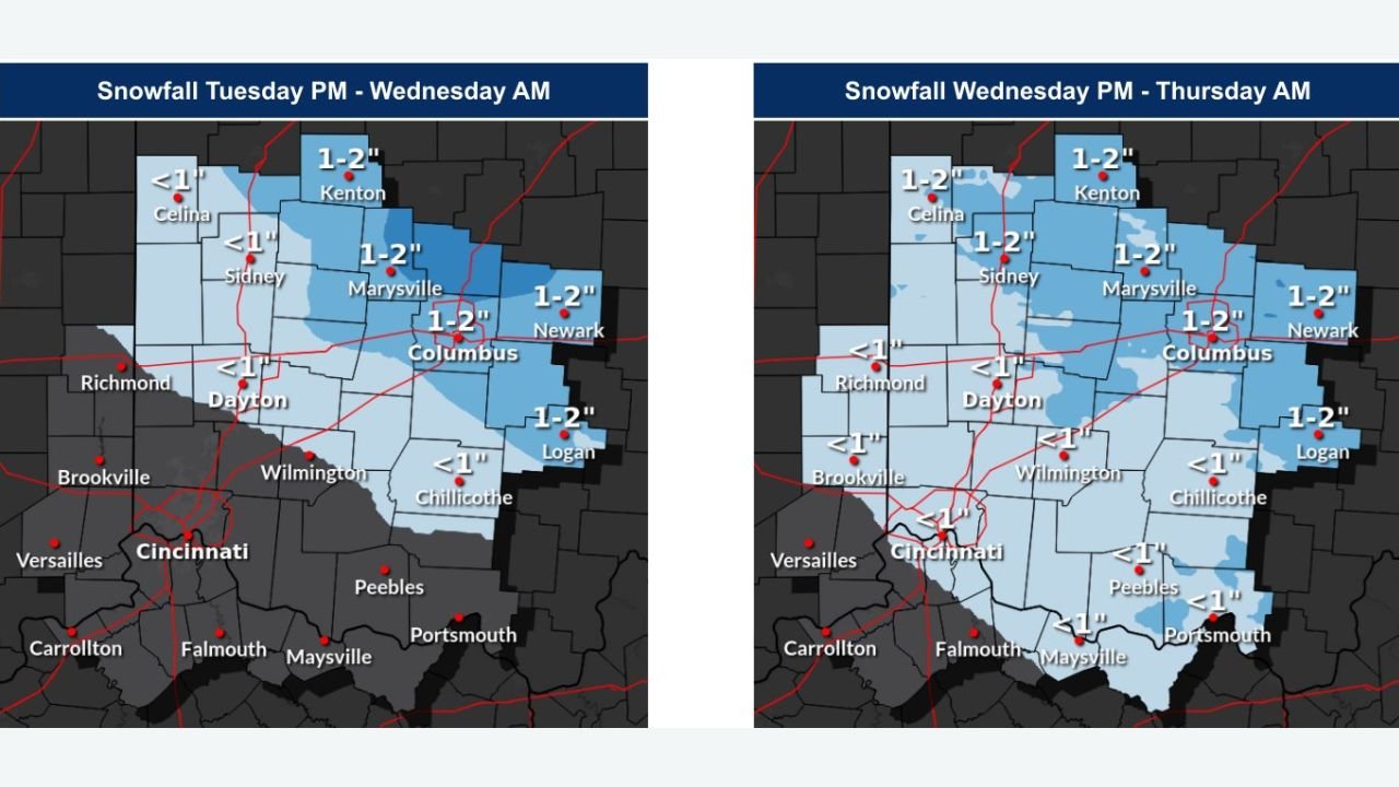
First Round Arrives Tuesday Night Into Early Wednesday
According to updated NWS guidance, the first wave of snow will move into Ohio tonight and continue into early Wednesday morning.
Forecast maps show the potential for 1 to 2 inches of accumulation stretching through cities such as Columbus, Marysville, Newark, Logan, and Sidney.
Some areas west of Columbus — including Dayton and Richmond — may see less than an inch, but slick roads and morning commute hazards remain likely.
Second Round Expected Wednesday Afternoon Through Early Thursday
A secondary system will push across the state Wednesday afternoon into early Thursday morning, bringing a fresh coating of snow across many of the same locations.
Forecast totals again indicate 1 to 2 inches in Columbus, Marysville, Kenton, Newark, Logan, and surrounding areas.
Communities to the south, including Wilmington, Chillicothe, Peebles, and Portsmouth, are expected to receive up to 1 inch, but impacts can still occur as temperatures remain cold enough for untreated surfaces to freeze.
Travel Impacts Possible Midweek
While the snowfall amounts are not expected to be heavy, the timing aligns with peak travel periods, and even light accumulations can create issues on highways and secondary roads.
Residents should be prepared for:
- Slippery road conditions, especially Wednesday and Wednesday night
- Reduced visibility during snow showers
- Longer commute times
- Rapidly changing conditions as two separate waves move through
The National Weather Service emphasizes that central Ohio will see the highest likelihood of travel disruptions, particularly during the Wednesday daytime and evening hours.
Stay tuned for continued updates throughout the week, and always check the latest NWS alerts before traveling. For more developing weather coverage, visit Waldronnews.com.