
Ohio, West Virginia, Pennsylvania, Maryland and Virginia Under Marginal Flash Flood Risk as Strong Storms Target Ohio Valley, Appalachians and Mid-Atlantic Sunday
CHARLESTON, WV — A developing cold front is expected to spark showers and thunderstorms across the Ohio Valley, Central Appalachians and Mid-Atlantic on Sunday, bringing the potential for strong storms and localized flash flooding in several states.
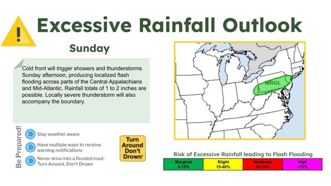
The latest Excessive Rainfall Outlook places portions of Ohio, West Virginia, Pennsylvania, Maryland and Virginia in a Marginal Risk (5–15%) zone for excessive rainfall capable of producing isolated flash flooding.
Cold Front to Trigger Afternoon Storm Development
Forecasters indicate that a cold front pushing through the region Sunday afternoon will serve as the primary trigger for storm activity. As warmer, moisture-rich air interacts with the advancing boundary, showers and thunderstorms are expected to develop and move eastward through the afternoon and evening hours.
The greatest concern stretches across parts of:
- Central and eastern Ohio
- Much of West Virginia
- Western and central Pennsylvania
- Western Maryland
- Northern and western Virginia
Rainfall Totals of 1 to 2 Inches Possible
Rainfall totals of 1 to 2 inches are possible in localized areas, particularly where thunderstorms repeatedly move over the same locations.
While widespread flooding is not anticipated, heavier downpours in a short period of time could overwhelm drainage systems, especially in:
- Urban corridors
- Poor drainage areas
- Low-lying roadways
- Smaller creeks and streams
The Weather Prediction Center categorizes the risk as Marginal, meaning isolated flash flooding is possible but not expected to be widespread.
Strong Thunderstorms Also Possible
In addition to heavy rainfall, locally strong thunderstorms may accompany the frontal passage. Gusty winds and brief intense rainfall rates are possible within stronger cells.
The overlap of instability and lift along the boundary could allow a few storms to briefly intensify before weakening later in the evening.
Timing: Sunday Afternoon Into Evening
Storms are expected to develop Sunday afternoon and continue into the evening hours as the cold front advances eastward toward the Atlantic coast.
Communities in the Appalachians and Mid-Atlantic should remain weather-aware through the late day period, particularly if outdoor plans are scheduled.
Safety Reminders
With any flash flooding threat, even localized:
- Avoid driving across flooded roadways.
- Monitor weather alerts throughout the day.
- Have multiple ways to receive warnings.
- Remember: Turn Around, Don’t Drown.
Though the risk level remains on the lower end, conditions can change quickly when thunderstorms produce heavy rainfall in a short time frame.
Stay with WaldronNews.com for continued updates on Sunday’s storm threat across the Ohio Valley, Appalachians and Mid-Atlantic.