
Severe Storm Risk Expands Across Oklahoma, Texas, Arkansas and Louisiana on Wednesday March 4 With Damaging Winds and Large Hail Possible
UNITED STATES — A developing storm system moving out of the Southwest is expected to increase thunderstorm chances across portions of Oklahoma, Texas, Arkansas and Louisiana on Wednesday, March 4, with the potential for severe weather by the afternoon and evening hours.
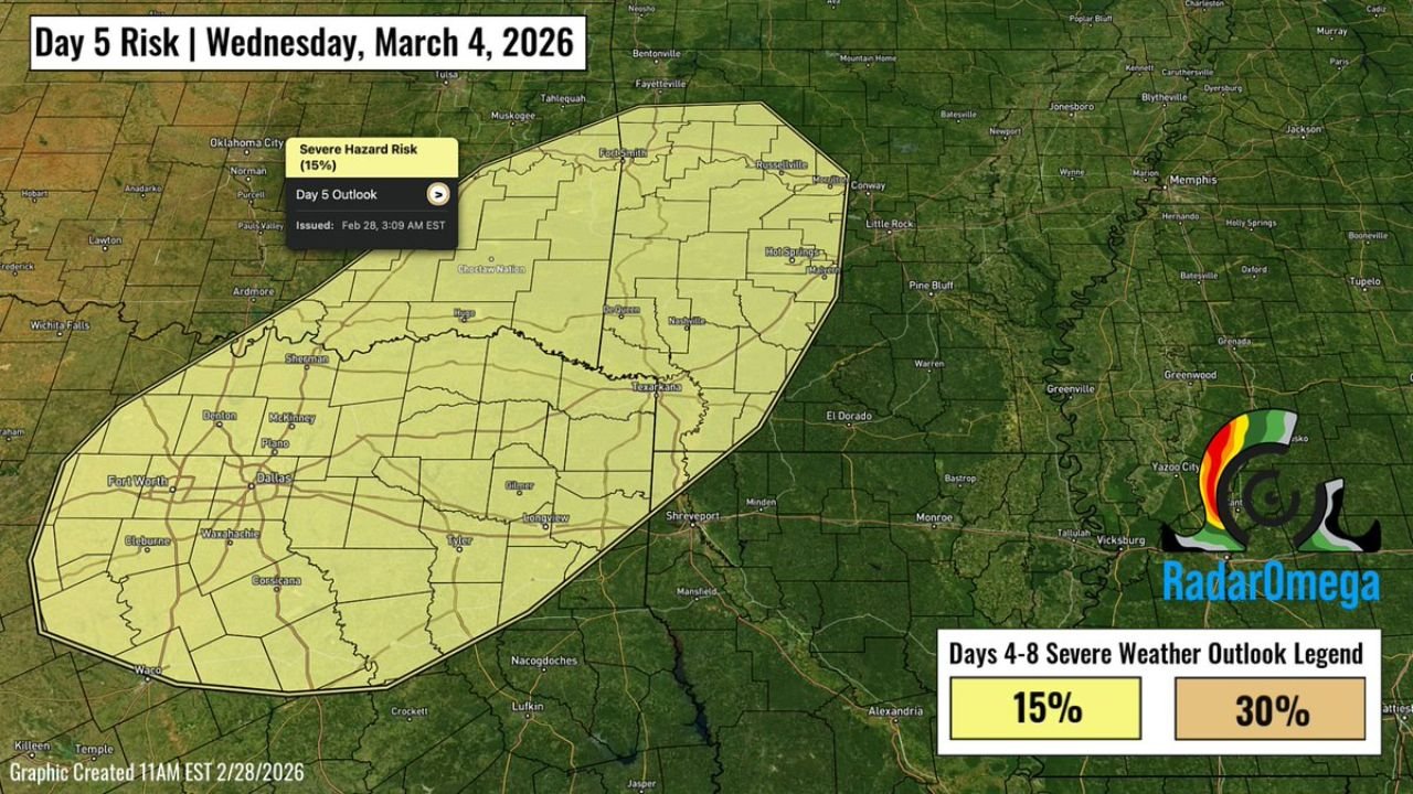
The Day 5 outlook highlights a 15 percent severe hazard risk zone stretching from central and eastern Oklahoma through northeast Texas, much of Arkansas, and into parts of northern Louisiana.
Areas Included in the Risk Zone
The highlighted corridor includes:
- Oklahoma: Including areas near Oklahoma City and extending eastward.
- Texas: Much of north and northeast Texas, including Dallas, Fort Worth, Sherman, Denton, McKinney, Tyler and Longview.
- Arkansas: Large portions of the state, including Little Rock, Russellville and surrounding communities.
- Northern Louisiana: Areas near Shreveport and bordering east Texas and southwest Arkansas.
The ArkLaTex region appears squarely within the projected risk area, along with the Ozarks and parts of the mid Mississippi Valley.
What Is Driving the Setup
Forecast discussion indicates that a trough lifting out of the Southwest will overspread the southern Plains and lower Mississippi Valley.
By Wednesday afternoon and evening:
- Moderate instability is expected to develop.
- Strong wind shear will be present.
- Conditions could support organized thunderstorms, including supercells.
Supercells are capable of producing damaging straight line winds and large hail. While tornadoes are not ruled out, current signals do not indicate a high end outbreak scenario at this time.
Timing of the Threat
Storm development is most likely during:
- Wednesday afternoon across Texas and Oklahoma.
- Late afternoon into evening across Arkansas and northern Louisiana.
- Potential eastward progression into portions of the lower Mississippi Valley overnight.
The strongest storms would likely form along and ahead of a cold front advancing eastward.
What Residents Should Watch
While this is currently categorized in the 15 percent severe probability range, it is still several days out. Forecast details regarding exact storm mode, instability levels and storm coverage will become clearer as Wednesday approaches.
Residents in:
- North and northeast Texas
- Eastern Oklahoma
- Arkansas
- Northern Louisiana
should monitor updates and ensure they have a way to receive weather warnings.
Bottom Line
A classic early March severe weather setup is taking shape across parts of Oklahoma, Texas, Arkansas and Louisiana for Wednesday, March 4. Damaging winds and large hail appear to be the primary threats, with isolated tornado potential still on the table depending on how instability and shear overlap.
Stay with WaldronNews.com for continued updates as confidence increases and details on timing and intensity become clearer.