
Severe Thunderstorm Warning Issued for Hendersonville, Gallatin, and Green Hill, Tennessee Until 10:30 PM CST
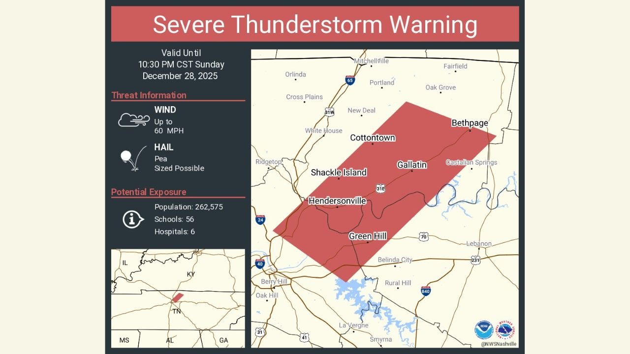
TENNESSEE — A Severe Thunderstorm Warning remains in effect until 10:30 PM CST Sunday, December 28, 2025, for parts of Sumner County, including Hendersonville, Gallatin, Green Hill, Shacklett Island, Cottontown, and surrounding communities, according to the National Weather Service.
Forecasters warn that this storm is capable of producing damaging wind gusts up to 60 mph, along with pea-sized hail. Officials also note that a brief tornado cannot be ruled out, making conditions especially dangerous for anyone outdoors or traveling during the warning period.
What Areas Are Affected
The warning polygon covers:
- Hendersonville
- Gallatin
- Green Hill
- Shacklett Island
- Cottontown
- Nearby portions of central Sumner County, Tennessee
Radar imagery shows a strong thunderstorm moving across the region, prompting emergency alerts due to its wind potential and rapid movement.
Main Threats From This Storm
- Wind gusts up to 60 mph, capable of downing trees and power lines
- Pea-sized hail, which may damage vehicles and outdoor property
- Isolated tornado risk, especially in stronger storm cores
- Power outages and debris on roadways possible
Emergency officials estimate the warning area includes a population of over 262,000 residents, with dozens of schools and multiple medical facilities within the impact zone.
Safety Officials Urge Immediate Precautions
Residents are advised to:
- Move indoors immediately and stay away from windows
- Secure loose outdoor objects that could become airborne
- Avoid travel unless absolutely necessary
- Be prepared to take shelter quickly if conditions worsen
If a tornado warning is issued, residents should move to an interior room on the lowest floor of their home.
What Happens Next
The storm is expected to continue moving east-northeast through late evening. Conditions may improve after the warning expires, but additional alerts could be issued if storm intensity increases.
Have you experienced severe weather in your area tonight? Share what you’re seeing and stay updated with the latest local alerts by following WaldronNews.com, where we continue tracking developing weather threats across the region.