
Southern Kansas Residents Advised To Stay Weather Aware As Evening Storms Bring Hail, 70 MPH Winds and Tornado Risk Tonight
KANSAS — Residents across southern Kansas, including Wichita, Hutchinson, Great Bend, Winfield, and Coffeyville, are being urged to stay alert this evening as severe thunderstorms are expected to develop and intensify through the overnight hours.
Forecast guidance indicates storms will begin forming by early evening and continue expanding northward late into the night, bringing multiple severe weather hazards across the region.
Storms Expected To Develop This Evening And Expand Overnight
The primary storm window is expected between:
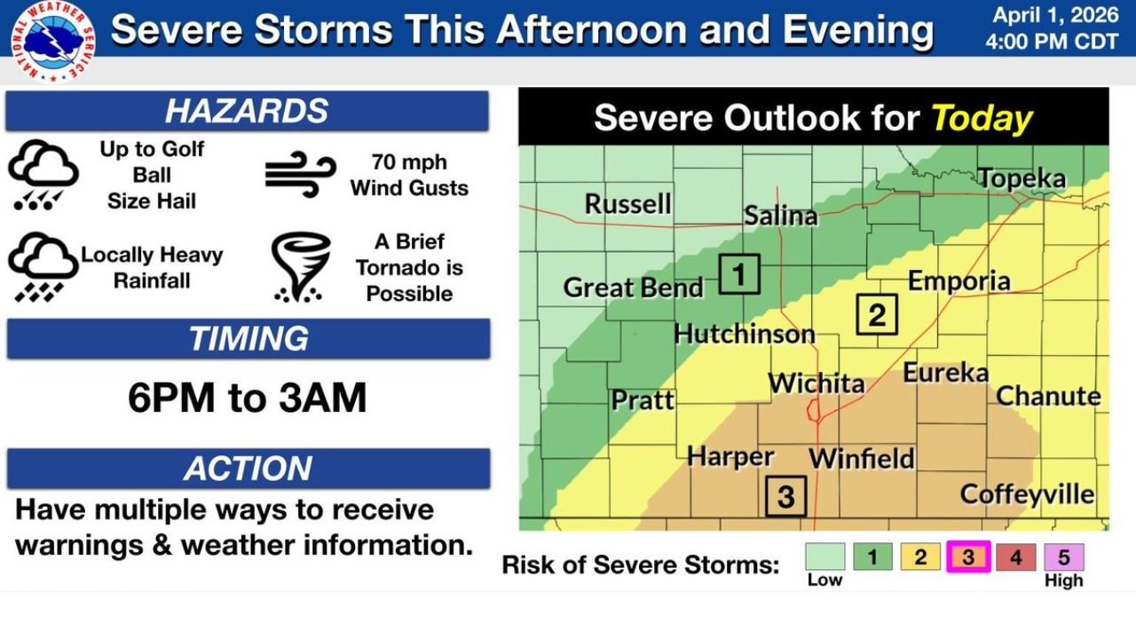
- 6 PM and 3 AM CDT
Storms are forecast to:
- Develop initially across southern Kansas
- Expand northward toward central parts of the state including Hutchinson and Great Bend
- Continue through the overnight hours with ongoing severe potential
Multiple Hazards Expected Across Southern Kansas
Residents should be prepared for a combination of dangerous weather conditions, including:
- Large hail up to golf ball size
- Damaging wind gusts reaching up to 70 mph
- Locally heavy rainfall that could reduce visibility and cause minor flooding
- A brief, isolated tornado cannot be ruled out
While tornado risk is lower compared to other hazards, it remains a concern, especially within stronger storm cells.
Highest Risk Zone Includes Wichita and Surrounding Areas
The severe weather outlook highlights:
- Moderate risk (Level 3) across areas near Wichita, Winfield, and Harper
- Lower but still notable risk levels extending north and east toward Hutchinson, Emporia, and Chanute
This means the most intense storms are likely to impact south-central Kansas, where conditions are most favorable for storm strengthening.
Rapid Changes Possible After Sunset
Evening and nighttime storms can be particularly dangerous because:
- Visibility is reduced, making hazards harder to recognize
- Storms can intensify quickly after sunset
- People are more likely to be indoors and unaware of rapidly changing conditions
Storms moving northward overnight could impact additional communities with little lead time between warnings and impacts.
Residents Urged To Prepare And Stay Connected
Officials are advising residents across Kansas to take precautions ahead of tonight’s storms:
- Ensure you have multiple ways to receive weather alerts
- Keep your phone fully charged with notifications enabled
- Identify a safe shelter location in your home
- Stay updated with local forecasts throughout the evening
Overnight Storm Threat Requires Extra Caution
With storms expected to continue into the early morning hours, residents should remain cautious even after midnight.
This setup could bring waves of strong storms across southern and central Kansas, making it critical for communities to stay alert and ready to respond if severe weather warnings are issued.