
Texas and Oklahoma Severe Weather Alert Issued as Weekend Storm Risk Expands from Amarillo to San Antonio and Oklahoma City
TEXAS AND OKLAHOMA — A developing weather setup is now signaling a strong return of severe storm potential heading into this weekend, with multiple areas across the Southern Plains being highlighted for back-to-back storm chances on Saturday and Sunday.
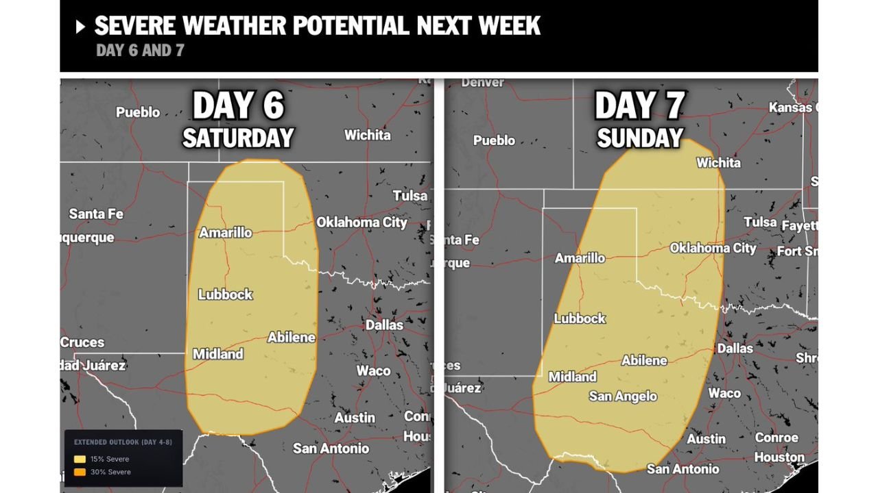
Forecast data shows a broad severe weather zone stretching across central and western Texas into western Oklahoma, raising concerns that the region is entering a more active and prolonged severe weather pattern.
Weekend Setup Signals Growing Severe Threat
The current outlook highlights two key timeframes:
- Saturday (Day 6)
- Sunday (Day 7)
Both days show overlapping risk areas, suggesting that storms may redevelop or persist across similar regions for consecutive days, increasing the overall impact potential.
Areas Most Likely to See Storm Development
The highlighted risk zone includes major cities and regions such as:
Texas
- Amarillo
- Lubbock
- Midland
- Abilene
- San Angelo
- Areas north of San Antonio
Oklahoma
- Western parts of the state
- Areas near and west of Oklahoma City
This corridor represents a classic Southern Plains storm track, where warm, unstable air meets incoming disturbances.
Why This Pattern Is Concerning
The setup indicates more than just a single storm event. Instead, it points toward:
- A multi-day severe weather pattern beginning this weekend
- Repeated storm development across the same regions
- Increasing instability as the pattern strengthens
This type of setup often leads to:
- Strong thunderstorms
- Large hail potential
- Damaging wind gusts
- Isolated tornado risk depending on storm organization
Back-to-Back Risk Increases Impact Potential
One of the most important factors in this forecast is the overlap between Saturday and Sunday risk zones.
This means:
- Areas impacted on Saturday could see additional storms on Sunday
- Ground conditions and atmospheric instability may carry over into the second day
- Storm intensity could increase if conditions align more favorably
Early Sign of a Longer Severe Weather Stretch
This weekend setup may also be the beginning of a longer active stretch across the Plains.
Forecast trends suggest:
- The pattern is becoming more favorable for frequent storm systems
- Severe weather season is ramping up rather than peaking yet
- Additional storm chances could follow into next week
What Residents Should Watch Closely
People across Texas and Oklahoma, especially within the highlighted zone, should monitor:
- Rapid forecast updates heading into the weekend
- Timing of storm initiation each day
- Any upgrades in severe weather outlooks
Preparedness is key as this setup has the potential to evolve quickly from scattered storms into more organized severe weather events.
What This Means Going Forward
This is not just a one-day event — it’s a clear signal that the Southern Plains are entering a more active severe weather phase.
With two consecutive days already flagged, and additional activity possible beyond that, residents should be ready for changing conditions and repeated storm threats.
Stay with WaldronNews.com for continuing updates as this weekend severe weather setup develops and expands across Texas and Oklahoma.