
Tornado Outbreak Alert Issued for Texas, Oklahoma, Kansas, Missouri and Arkansas as Most Active Pattern Since 2011 Emerges
UNITED STATES — A major severe weather alert has been issued across the Central and Southern Plains, as new forecast data signals the most active tornado pattern seen in years could develop starting next week.
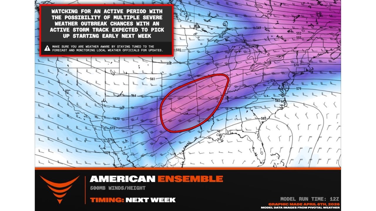
The setup points toward a highly energized storm track stretching from Texas through Oklahoma, Kansas, Missouri, and Arkansas, with conditions aligning for multiple rounds of severe storms and possible tornado outbreaks.
Historic-Level Pattern Beginning to Take Shape
Forecast guidance suggests this could become:
- One of the most active tornado periods since 2011
- A multi-day severe weather setup, not just a single event
- A pattern capable of producing repeated storm systems across the same regions
The environment is being driven by a series of strong upper-level troughs, creating a continuous pipeline for storm development.
Core Risk Zone Identified
The highest concern area currently includes:
- Texas Panhandle
- Oklahoma
- Kansas
- Missouri
- Arkansas
This region sits directly under the projected storm track, where atmospheric conditions will be most favorable for organized severe weather.
Timeline of the Developing Threat
The pattern is expected to evolve as follows:
- Friday to Saturday → Initial development across the Texas Panhandle and Southern Plains
- Sunday → Expansion across Oklahoma and surrounding areas
- Monday → System shifts northeast toward Missouri and beyond
This progression suggests a classic Plains-to-Midwest storm evolution, increasing the geographic reach of the threat.
Multiple Severe Weather Rounds Likely
One of the biggest concerns is the repetitive nature of the pattern:
- Storm systems may arrive back-to-back over several days
- Each round could bring damaging winds, large hail, and tornado potential
- Risk may not end after the first event — additional outbreaks could follow
This type of setup significantly raises the potential for widespread impacts.
Why This Pattern Is So Dangerous
Several key ingredients are coming together:
- Strong upper-level energy (jet stream support)
- Persistent storm track across the Plains
- Favorable conditions for organized severe thunderstorms
Together, these factors create an environment where storms can intensify quickly and maintain strength over long distances.
Areas That Should Closely Monitor Conditions
Residents in the following states should stay alert:
- Texas
- Oklahoma
- Kansas
- Missouri
- Arkansas
Additional impacts could extend into Illinois and parts of the Midwest as systems track northeast.
What to Expect Moving Forward
As this pattern develops, expect:
- Increasing severe weather alerts and updates
- Potential for rapidly changing conditions
- Multiple days with heightened storm risks
This is not a one-day event — it is shaping up to be a prolonged severe weather period.
Situation Requires Immediate Attention
With a setup this strong and widespread, early awareness is critical. The combination of timing, location, and repeated storm chances makes this a pattern that cannot be ignored.
Stay with WaldronNews.com for continuous updates as this potentially historic tornado pattern unfolds across the Plains and Midwest next week.