
Tornado Risk Tuesday Across Illinois Indiana and Michigan With Severe Storm Threat Targeting Chicago Rockford South Bend and Northern Midwest
ILLINOIS — Meteorologists are warning of a serious severe weather threat developing Tuesday afternoon and evening across northern Illinois, northern Indiana, and southwest Michigan, where conditions may support tornadoes, large hail, and damaging winds as storms move through the region.
Forecast analysis suggests the most dangerous storms could develop in a corridor stretching from eastern Iowa through northern Illinois and into northern Indiana and southwest Michigan, placing several major Midwest cities within the potential severe weather zone.
Northern Illinois and Indiana Could See the First Storm Development
Weather models indicate that northern Illinois may become a key area for storm initiation, especially near and west of the Chicago metropolitan area.
Communities including Rockford, Chicago, and surrounding counties in northern Illinois could see storms develop or intensify during the afternoon hours as warm, unstable air moves into the region.
As storms move east, the severe weather threat is expected to expand toward northern Indiana, including areas near South Bend and surrounding communities.
Isolated Supercells Could Bring Tornado Risk
Meteorologists say the atmosphere may support isolated supercell thunderstorms, which are rotating storms capable of producing the most severe weather.
These storms could generate:
- Tornadoes
- Very large hail
- Damaging straight-line winds
If supercells form ahead of a larger storm line, the tornado risk could increase across parts of northern Illinois, northern Indiana, and southwest Michigan during the late afternoon and early evening hours.
Southwest Michigan Also in the Severe Weather Corridor
As storms track northeast, the severe weather threat may continue into southwest Michigan, where storms could move inland from the southern Lake Michigan region.
Areas near Benton Harbor, Kalamazoo, and surrounding communities in southwest Michigan could experience severe storms capable of producing damaging winds or hail.
Because this region sits near the intersection of several atmospheric boundaries, storms entering Michigan may strengthen quickly if the environment remains favorable.
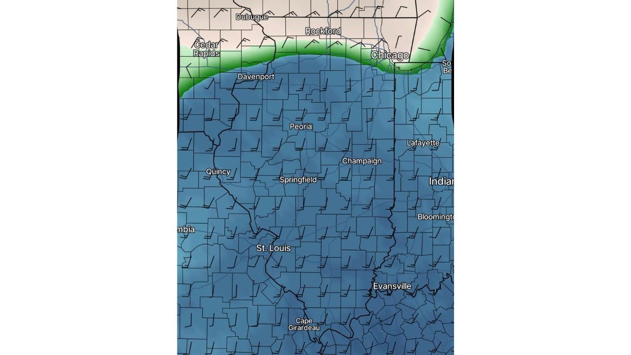
Wind Patterns Suggest Organized Storm Development
Wind maps show strong directional wind flow across Illinois and Indiana, which is an important ingredient for severe weather development.
When wind speeds increase and change direction with height in the atmosphere, thunderstorms are more likely to rotate and organize into stronger structures capable of producing tornadoes.
This pattern suggests that storms forming Tuesday afternoon could evolve into organized severe thunderstorms moving across the Midwest.
Residents Urged to Stay Weather Aware
Although forecast details may continue to evolve as Tuesday approaches, meteorologists stress that residents across northern Illinois, northern Indiana, and southwest Michigan should closely monitor weather updates.
Severe storms can intensify rapidly during the spring severe weather season, and conditions may change quickly once storms begin to develop.
Residents should review severe weather safety plans and ensure they have multiple ways to receive weather warnings in case storms become dangerous.
Stay with WaldronNews.com for continuing updates as meteorologists monitor the developing severe weather threat expected across Illinois, Indiana, and Michigan Tuesday.