
Two-Week Snowfall Outlook Signals 3+ Inch Accumulation Risk North of the I-95 Corridor While Coastal Cities May See Only Flurries Across New York and New England
NORTHEAST UNITED STATES — A newly released two-week snowfall outlook suggests a sharp divide in snow potential across the urban and coastal corridor of the Northeast, with colder air favoring measurable accumulation farther inland while major coastal cities may see limited impacts.
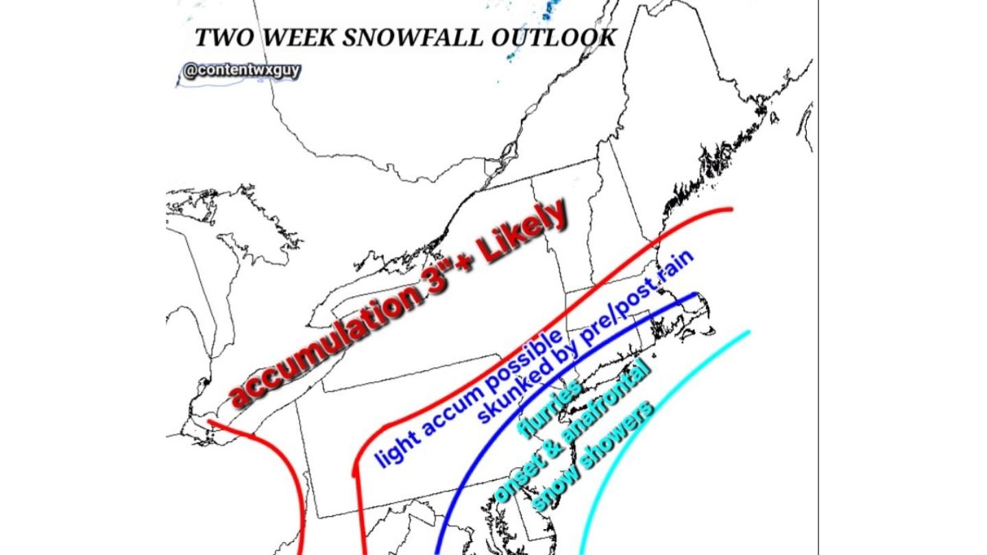
The outlook highlights a zone of 3 inches or more likely stretching from portions of upstate New York through interior New England. Meanwhile, areas closer to the I-95 corridor — including parts of southern New England and the New York City metro region — appear more marginal, where precipitation type and timing could significantly reduce snow totals.
3+ Inches Favored Inland
The highest confidence for meaningful snowfall lies north of the immediate coastal plain. The outlook outlines a broad swath across:
- Interior New York
- Much of Vermont and New Hampshire
- Interior Massachusetts
- Parts of Maine
In these areas, colder air is expected to be more established during potential storm windows over the next two weeks, allowing for accumulating snowfall events.
The signal suggests that at least one system during the period could bring widespread 3-inch-plus totals across interior sections.
Coastal Corridor: Light Accumulation Possible, But Not Guaranteed
Closer to the coast — including areas along Long Island, southern Connecticut, Rhode Island, eastern Massachusetts, and possibly parts of coastal New Jersey — snowfall appears more conditional.
The outlook indicates:
- Light accumulation possible
- Precipitation potentially “skunked” by pre- or post-rain scenarios
- Marginal thermal profiles near the shoreline
This suggests that if storm tracks shift slightly warmer, rain could mix in or dominate, limiting totals along the urban corridor.
Flurries and Frontal Snow Showers Possible
Farther south and east, especially along the Mid-Atlantic coast, the outlook notes the possibility of flurries or brief frontal snow showers rather than widespread accumulating events.
These would likely be fast-moving systems tied to colder air intrusions rather than prolonged coastal storms.
“Aggressively Cold” Pattern for Urban Areas
The outlook references a notably cold signal across parts of the region. If sustained cold air locks into place over the next two weeks, even coastal cities could become more susceptible to accumulating snow.
However, the setup appears delicate. A small shift in storm timing or track could determine whether major population centers see accumulating snow or mostly rain.
What This Means Going Forward
The two-week window suggests:
- Interior Northeast: Best chance for meaningful accumulation
- I-95 corridor: Lower confidence, dependent on temperature profiles
- Coastal zones: Higher risk of mixed precipitation
Forecast confidence at this range remains moderate, and individual storm systems will need to be monitored closely.
For now, residents across New York and New England — especially north of the coastal plain — should prepare for at least one measurable snowfall event within the next two weeks.
WaldronNews.com will continue monitoring evolving storm tracks and temperature trends as this potentially impactful late-season snowfall pattern develops across the Northeast.