
Washington Cascade Passes Brace for Heavy Snow as Friday Storm Disrupts I-90 Travel Over Snoqualmie Pass
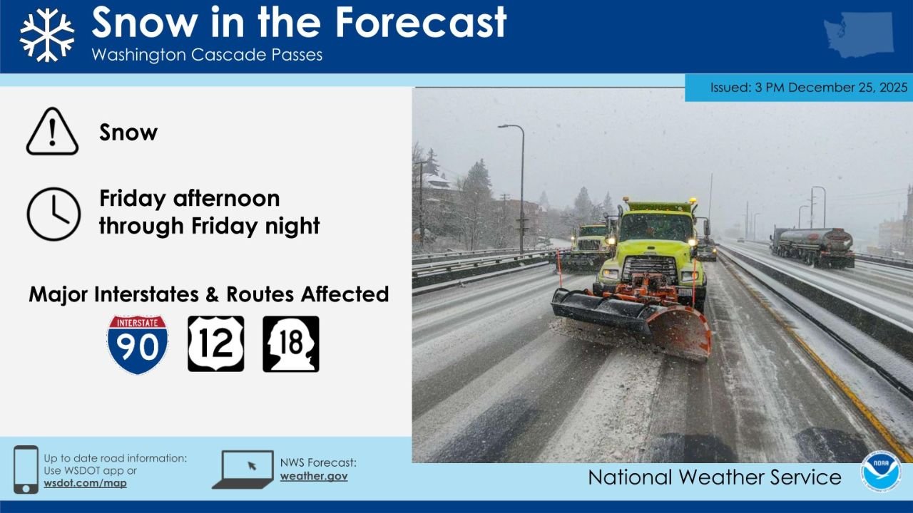
WASHINGTON — Another significant round of mountain snow is expected to impact the Washington Cascades from Friday afternoon through Friday night, creating hazardous travel conditions across major mountain passes, including Interstate 90 over Snoqualmie Pass. The National Weather Service warns that snowfall will intensify through the evening hours, with plow crews actively working to keep routes open as conditions deteriorate.
Drivers are urged to prepare for snow-covered roads, reduced visibility, chain requirements, and possible travel delays, especially on high-elevation highways.
Snow Timing and Travel Window
Snow is forecast to develop Friday afternoon and continue through Friday night, with the most persistent snowfall occurring during the evening and overnight hours.

Key timing highlights:
- Snow onset: Friday afternoon
- Heaviest snow: Friday evening into overnight
- Lingering impacts: Early Saturday morning in higher elevations
Because temperatures remain cold enough in the Cascades, precipitation will fall entirely as snow, with no rain mixing at pass level.
Snowfall Totals Focused on Cascade Passes
Forecast snowfall maps indicate substantial accumulations across Washington’s Cascade passes, with the highest totals in the central and southern Cascades.
Expected totals include:
- Snoqualmie Pass: 8–12 inches
- Stevens Pass: 8–12 inches
- White Pass: 8–12 inches
- Rainy Pass: 4–6 inches
- Higher terrain near Mount Baker and North Cascades: 1–2 inches, with locally higher amounts in favored slopes
Snowfall rates may become heavy at times, especially during the evening, making plowing operations challenging and travel conditions rapidly changeable.
Major Highways and Routes Affected
Several key transportation corridors are expected to be impacted, including:
- Interstate 90 (Snoqualmie Pass)
- U.S. Route 2 (Stevens Pass)
- U.S. Route 12 (White Pass)
- State Route 18 connecting western Washington routes
Transportation officials emphasize that I-90 over Snoqualmie Pass will see the greatest impacts, with potential for slow-moving traffic, spinouts, and temporary restrictions if snowfall intensifies.
Road Crews and Safety Guidance
Snowplows and treatment crews are already staged in the Cascades, but officials stress that drivers should not expect bare pavement during the height of the storm.
Travel safety reminders include:
- Carry chains or approved traction tires
- Allow extra travel time
- Keep emergency supplies in vehicles
- Avoid unnecessary mountain travel during peak snowfall
Road conditions can change quickly, particularly near pass summits and shaded stretches of highway.
Bottom Line
A Friday afternoon through Friday night snowstorm will bring heavy accumulating snow to Washington’s Cascade passes, with 8–12 inches likely at Snoqualmie, Stevens, and White Passes. Travel on I-90 and other major mountain routes will be difficult, and motorists should plan accordingly or delay travel if possible.
WaldronNews.com will continue monitoring conditions and provide updates as snowfall totals and travel impacts become clearer.